Route
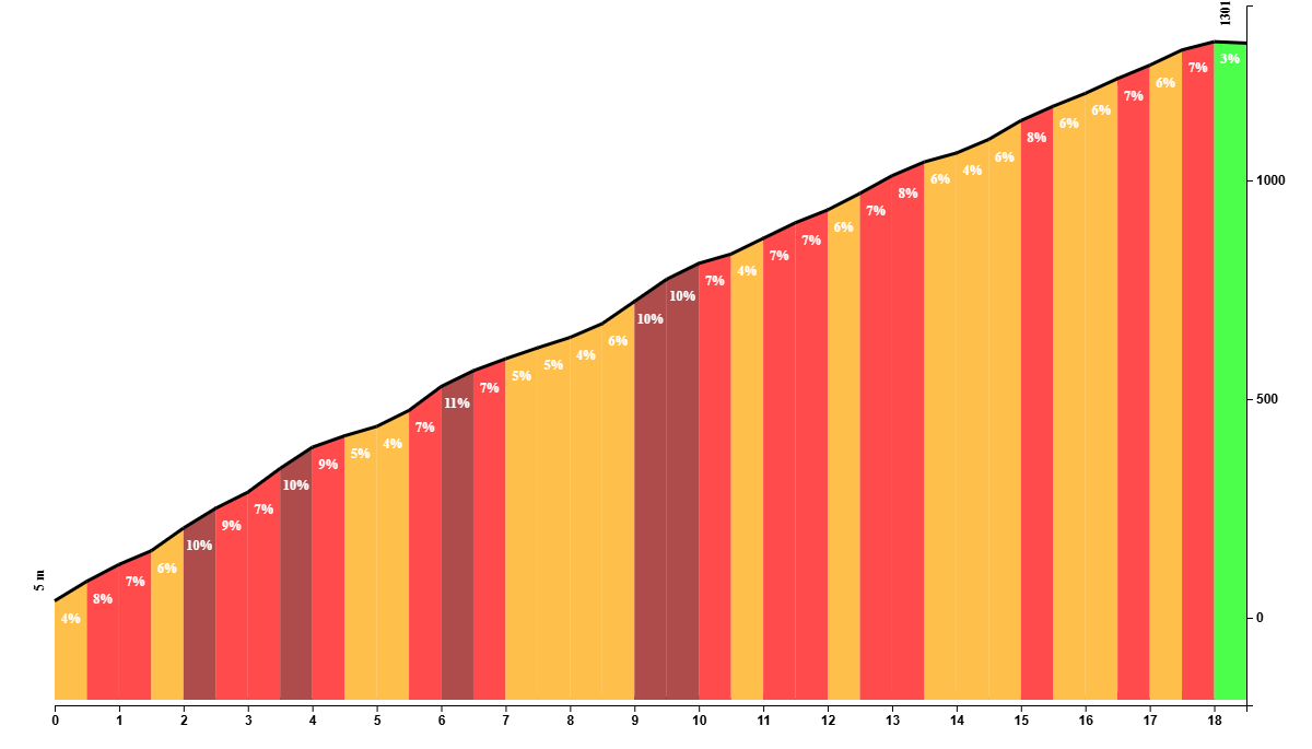
The ride begins with a formidable ascent to the summit of Haza del Lino, climbing 1300 meters over 18 kilometers. This tough climb features long stretches of 9-10% gradient and a few steep hairpin corners, testing your endurance and determination.
However, the reward at the top is well worth the effort, offering a sense of accomplishment and anticipation for the ride ahead.
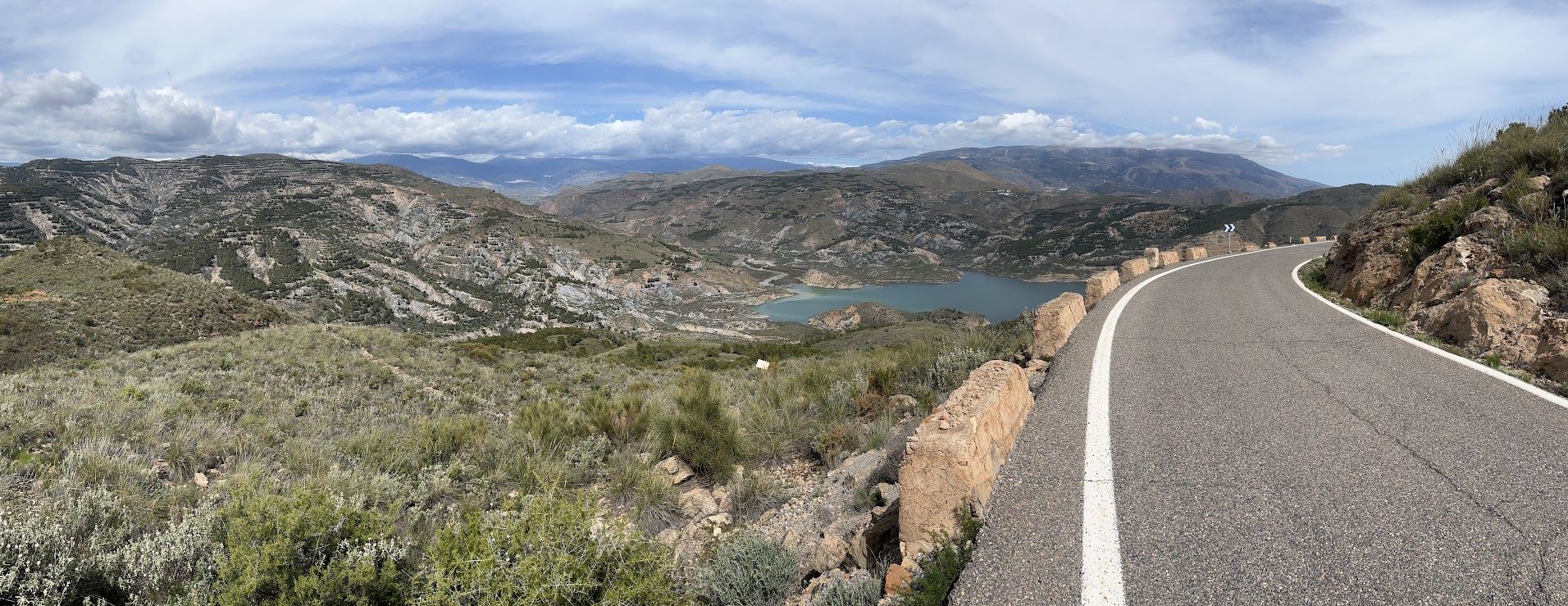
Once you conquer the climb, the route takes you along an undulating ridge. Here, you are treated to a visual feast of natural beauty. To your left, the majestic, snow-capped peaks of the Sierra Nevada rise majestically against the sky. To your right, the sparkling waters of the Costa Tropical stretch out to the horizon, creating a stunning contrast of landscapes.
The descent from the ridge to the embalse of Beninar is both fun and technical, demanding focus and skill. This thrilling segment of the route keeps your adrenaline pumping as you navigate the twists and turns, all the while surrounded by the serene beauty of the Andalucían countryside.
Continuing from the embalse of Beninar, the route leads you toward the expansive greenhouses of Almeria, an absolute eyesore to this otherwise brilliant landscape. This area, known for its agricultural prowess, presents a unique landscape of orderly rows of crops sheltered under vast stretches of greenhouse plastic.
As you head back to the starting point, the route takes you along a windy coastal road. If you’re lucky, the wind comes from the east and you can cruise back to the starting point. But more often than not, it’s head wind and you’ll be working hard to hit 20 km/h. Either way, this is an epic ride and one that I definitely recommend if you have time and want to make a little detour to this less-visited area.
Fueling up
At the top of the climb, conveniently, is a cafe. Ideal spot to fill up your bidons, as there aren’t many places in the hills. There’s another restaurant ‘Venta del Tarugo’ on the A-345.
Tips
Take enough food and fill up your bidons before you leave as there is almost no civilization on this route. For the same reason, it’s essential to bring the necessary tools to fix mechanical issues.
You Might Also Like


Ruta de la Cabra
The Goat's Path is an absolute beauty and must-do when you're in the area.


Sierra de Tejeda
One of the favorite loops of the pros when preparing for the Tour de France.


Granada - Purullena - Granada
The 'easy' part of the Gran Fondo ride.
Read more
Articles covering this route, region, or country.

Top 5 cycling routes in Granada
Explore the best cycling routes in Granada. Snow-capped mountain climbs, empty valleys, butter-smooth roads, and historic cities are perfect for your next cycling holiday in Spain.

10 epic road rides in Andalucía
Discover 10 epic road cycling routes in Andalucía, Spain. Perfect for scenic rides, challenging climbs, and unforgettable cycling adventures.

Top 5 cycling routes in Málaga
Explore the best cycling routes in Málaga. Sunny coastal rides, mountain climbs, and scenic roads perfect for your next cycling holiday in Spain.