
the regular cyclist
Epic routes. Hidden gems. Your next cycling adventure starts here.
Latest videos
Watch our most recent cycling adventures and route explorations.
Newest routes
The latest editions to the ever-growing repository of cycling routes.


Collado Bermejo from Totana
A 42 km loop from Totana straight up the Collado Bermejo climb (8.44 km at 6.7%) into the Parque Regional de Sierra Espuña, returning via the traffic-free Canal Principal de la Margen Derecha service road and a stinging punchy climb back to the sanctuary.

Sierra Espuña loop
A 130 km loop from Totana into the Parque Regional de Sierra Espuña, with the big Collado Bermejo climb between km 95 and 119.


Velefique & Collado del Ramal
A brutal desert double-header linking Alto de Velefique with the savage Collado del Ramal.


Vía de la Plata & Ruta del Agua gravel loop
A gravel loop following sections of the Ruta Vía de la Plata and the Ruta del Agua through the Sevilla countryside.


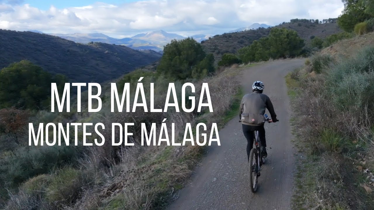
MTB Montes de Málaga: Full Loop
An epic MTB adventure through the Montes de Málaga. Starting from the capital, you climb past the botanical gardens to the dam before tackling steep, rocky trails to Vendo Miel. The narrative is relentless: unforgiving climbs on weathered trails, sinkholes, loose rocks, and gradients exceeding 20%. It feels like 70km of climbing and 25km of concentrated descent. At 800m altitude, a deceptive plateau offers brief respite before a final brutal climb to Mirador Vázquez Sell. Sanctuary comes at a cost: this is a properly tough ride where you won't see another soul for hours.


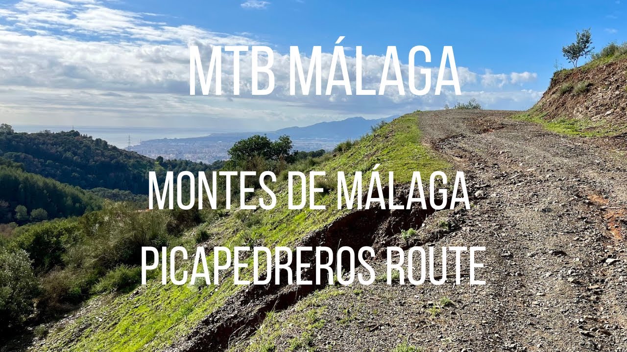
MTB Montes de Málaga
A mountain bike route that follows more or less the Picapedreros route, goes up to the mirador and then flies down back to Málaga.


Vía Verde de la Sierra de la Demanda
A gravel cycling route along an abandoned railway track. Most of the route is gentle, but be prepared for very steep alternative tracks around closed tunnels, including one section reaching 26% gradient.


Costa del Sol Gran Fondo
The official Costa del Sol Gran Fondo route: 130km of spectacular cycling through Sierra Bermeja and traditional white villages.


Masca via Buenavista del Norte
An epic route exploring the northern coast via Icod and Buenavista del Norte before climbing to the spectacular village of Masca.


Teide from Puerto de la Cruz (via Santiago del Teide)
An epic route climbing Mount Teide and returning via the scenic western route to Puerto de la Cruz.
Featured posts
Our latest articles and cycling guides.


Destinations
Some of the top destinations for your next cycling trip.
Spain
Need help planning your cycling holiday in Spain?
Check out these comprehensive guides:
France
Need help planning your cycling holiday in France?
Check out these comprehensive guides: