Sierra de la Pandera
This ride starts in Jaén, deep in the olive heartlands of Andalucía, and takes on one of the region’s most legendary climbs: Sierra de la Pandera.
The quick rise to fame
Part of its mythical status can be attributed to epic battles during the Vuelta a España.
Legend has it that a local cycling enthusiast wrote a letter to the race organizers, suggesting the climb after discovering that the road to the (disused) military base was open to the public. The organizers of the Vuelta, eager for steep mountain finishes, loved the idea and included La Pandera soon after in the 2002 edition. The stage was won by Roberto Heras, who would go on to win the Vuelta a España four times in his career.
The Vuelta doesn’t frequent the Pandera all that much (at the time of writing, in 2025, they did it 6 times), but when they do, it’s near certain that it’ll be action-packed. The last passage was in 2022 when Richard Carapaz won, and Roglič attacked Evenepoel’s lead. Previous passages were equally heroic with GC contenders going head to head, like Alberto Contador and Chris Froome in 2017, Alejandro Valverde and Samuel Sanchez in 2009, and a younger Alejandro Valverde vs Roberto Heras in 2003. Indeed, this climb is not for pancakes.
On TV, it’s almost impossible to grasp how steep the roads truly are. For this particular ride, the climb profile is also misleading. But make no mistake: this mountain packs a serious punch. It’s remote, steep, dramatic, and, for much of the year, sweltering.
Los Villares to the mouth of the beast
From Jaén, the route eases you in with gentle riding over rolling terrain along the A-6050, heading south toward Los Villares. To me, the town has a last frontier vibe, because after this point you’re surrounded by nothing but olive trees and towering mountains.
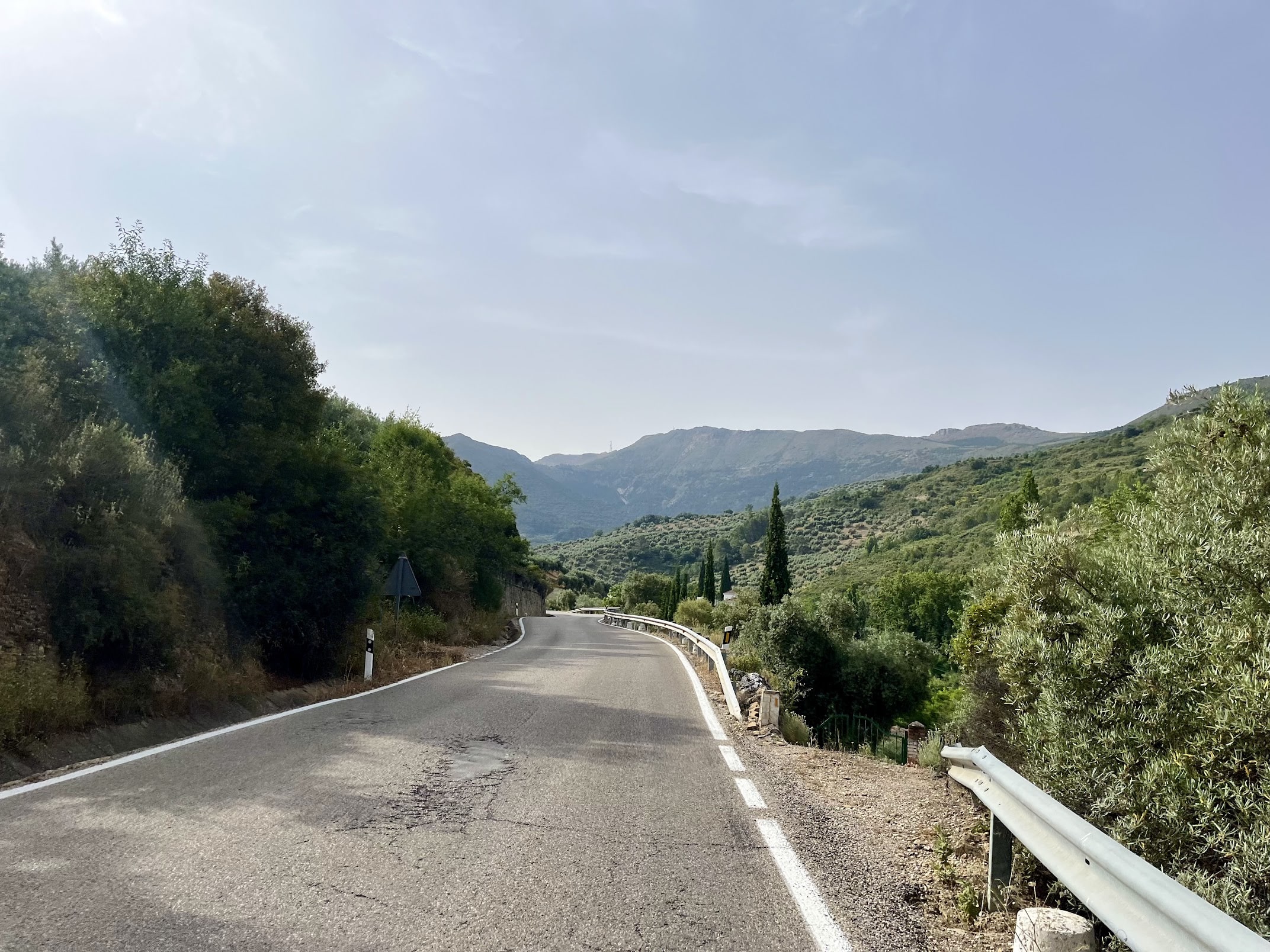
After Los Villares, the road gradually begins to climb. This ascent has it all: light traffic, courteous drivers tending to their farms, plenty of corners, a decent road surface, great views, and gradients that rarely exceed 8%. Along the way, you’ll pass the source of the Riofrío River; the sound of gushing water is unexpected in such an arid landscape!
Fairly early in the ride, you’ll spot the antennas of La Pandera looming in the distance, a not so subtle reminder of what’s to come. There’s still a long way to go, though. To my surprise, the first part of the climb already racked up 750 meters of elevation. Not bad at all for a warm-up before the main event.
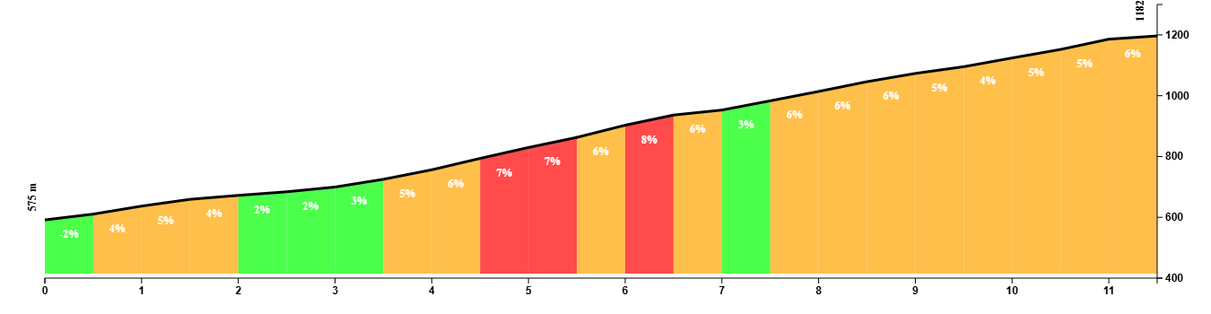
Use the short descent on those glorious roads to eat, drink, and get ready for the climb ahead. The entrance to this mythical climb honestly looks like someone’s driveway and is easy to miss if you are not paying attention. I should know, because I took the wrong exit and ended up on gravel roads leading into the quarry, only to be chased by a pack of hungry dogs. That certainly got my blood pumping by the time I finally found the right road. If you’re in desperate need of some adrenaline, I recommend this 100%.
La Pandera, part 1: starting off with a bang
The Sierra de la Pandera is a relentless ascent with an average gradient of around 7 percent, or 8.5 percent if you exclude the final stretch that descends toward the military base. Over just 7 kilometers, you gain 650 meters of elevation. Based on the numbers, I make it sound more daunting than it really is, but it is the steep ramps that make this climb a real challenge. Gradients over 15 percent are not uncommon. Ironic road signs occasionally remind you of that.
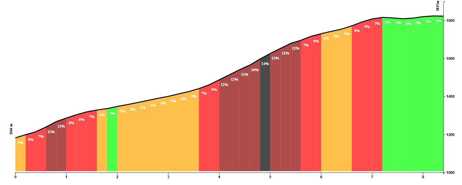
The suffer fest begins almost immediately, with gradients jumping into double digits as you pass the quarry. Long, exposed stretches offer no relief, making the climb even more difficult. This is just a sneak preview of what awaits near the end, where things really get tough.
La Pandera, part 2: is my Garmin not working correctly? I’m seeing single digits!
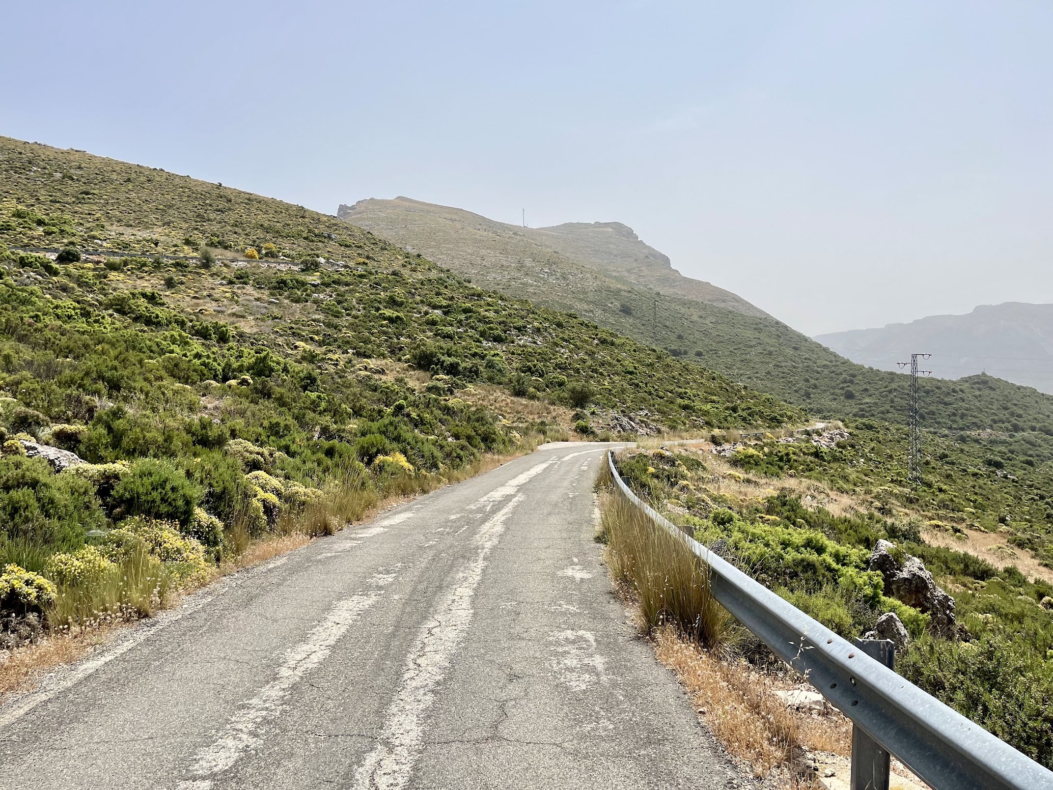
The second part is the easiest, with very gentle gradients that seem almost unworthy of this mountain. The road snakes its way up, and because there are no trees, you can see exactly where it leads. Spoiler alert: you really have to look up. Enjoy the view, take some pictures, have a sip of water, and above all, take it easy on your legs because you will need all the energy you have.
La Pandera, part 3: conquering the monster
Around the 4-kilometer mark, the most brutal section finally begins. Gradients never drop below 10 percent and often spike to 15 percent or more in some corners. There are no places to recover, and no shelter from the elements. The sun beats down relentlessly and the wind offers no relief.
It is 20 to 30 minutes of constant grinding in the smallest gear, rocking from side to side, and sometimes standing out of the saddle to find some speed and get over the mountain alive. Only when you reach the second set of antennas does riding start to feel human again.
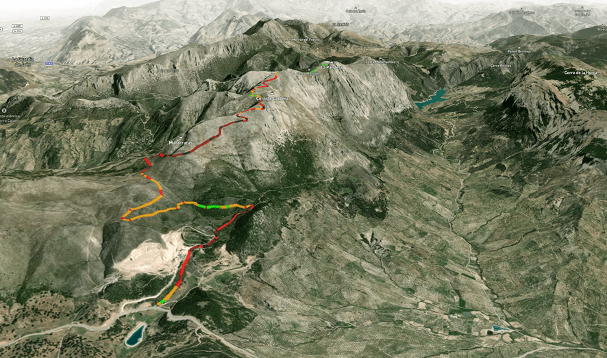
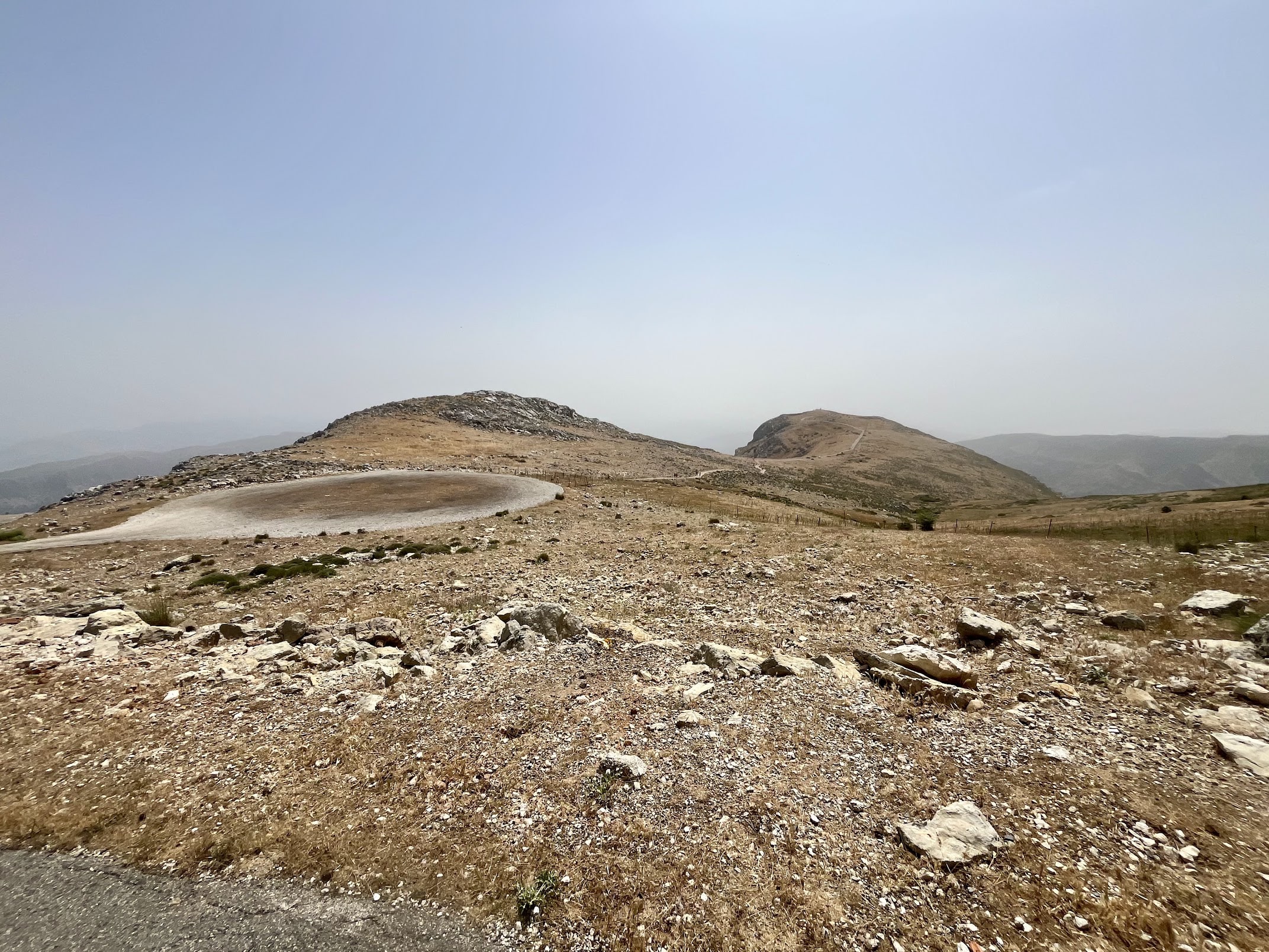
As you approach the summit, the views open wide across the Sierra Sur, and the final few kilometers to the abandoned military base at the top feel like something out of a science fiction movie.
It is not the prettiest mountaintop, but the surroundings are truly breathtaking. There are almost 360 degrees of views over the area. Hikers continue across the plateau to Peña Del Altar, where even more spectacular sights, such as the Embalse del Quiebrajano, await.
It’s a proud moment for every normal cyclist to stand there at the top, realizing they just climbed the Sierra de la Pandera.

The home stretch
With just 32 kilometers covered, you will have already gained over 1400 meters of elevation. You could call it a day and head back to Jaén the same way you came. I would not blame you, I thought about it more than once on a hot June day when temperatures neared 40 degrees Celsius.
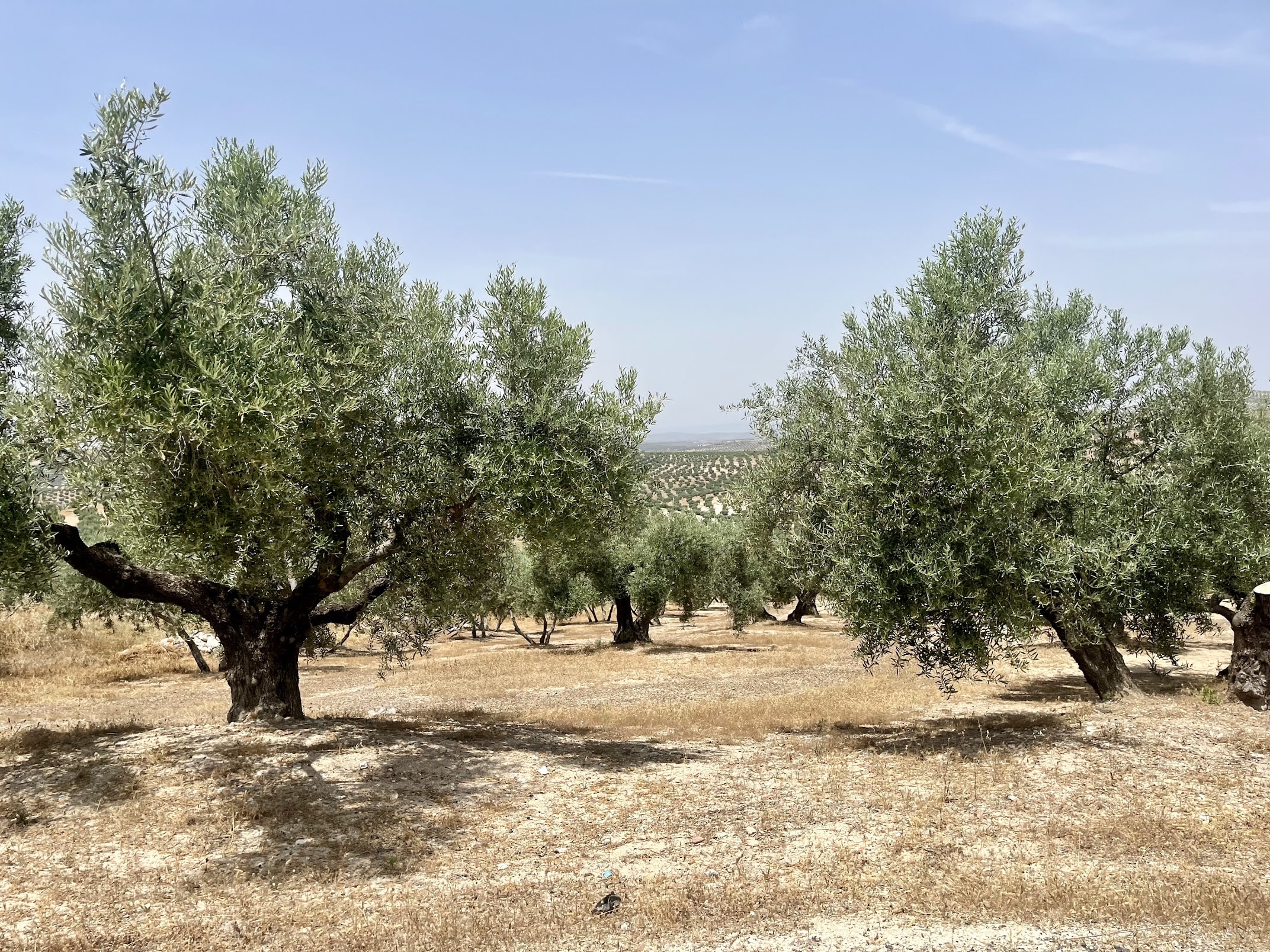
If your legs are still holding up and you have not yet been roasted in the oven that is inland Andalucía, you can take a short detour to Martos, the olive oil capital of the world. The terrain is gently rolling on quiet roads through a surreal landscape filled with thousands upon thousands of olive trees stretching as far as the eye can see.
In Torredelcampo, you will cross another iconic route: the Vía Verde del Aceite. While the Vía Verde heads straight for Jaén, this route continues a little further to bring the ride up to the 100-kilometer mark. The fast A-311 road to Jaén is a necessary evil and possibly the only part of the route I could have done without.
Back in Jaén, celebrate with some refreshing beverages and be sure to explore this charming town and its impressive cathedral.