Carretera de la Cabra
Route
This is an absolute beauty of a ride. La Carretera de la Cabra, the Goat’s Path, connects Almuñécar to the magnificant city of Granada, and was originally used to transport fish on the back of mules to the city. It took them two days to traverse the path. Today, it is an attractive area for hikers, bikers, and cyclists. The pros are known to frequent this route a lot when they’re preparing for the Tour de France on their altitude camp in the Sierra Nevada.
The ride starts at the coast in Almuñécar. Once of historic importance to the Phoenicians and the Romans, now a great base for tourism at the less-visited Costa Tropical. There are a few decent diving spots at the neighbouring La Herradura (‘The Horseshoe’), places for sightseeing in the town itself such as the castle, beaches, water holes (Rio Verde in nearby Otívar), and it’s a good starting point to go up the Goat’s Path.
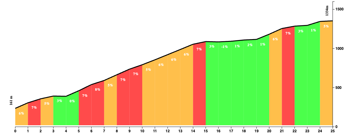
Almuñécar is not a large town, so you’ll be out and about in the countryside in no time. Look for the A-4050 and once you’re on it, that’s the only road you have to follow for the next 30 km. In contrast to many other rides that start from the coast, the start is actually quite relaxed and it only goes uphill ever so slightly, so you can warm up your legs for once before the proper climbing starts.
The first kilometers of this road aren’t anything to write home about as you ride through urbanizations, but it doesn’t take long before it gives way for beautiful countryside. Along the way are two small villages, Jete and Otívar. Once out of Otívar is where the gradients start to kick up.

There aren’t any killer sections to worry about and you can settle into a rythm that you can keep up for another 10 km or so. The further you dig deeper inland, the more spectacular this ride gets. The perfect tarmac road however starts to degrade quite a bit and the potholes and cracks tend to get bigger as you go along. It’s a small price to pay for such dramatic landscapes, where the green valley gives way for desert the higher you go. The altitude won’t take your breath away yet, but the dramatic rock formations might do and you may be tempted to stop around every corner to take pictures.
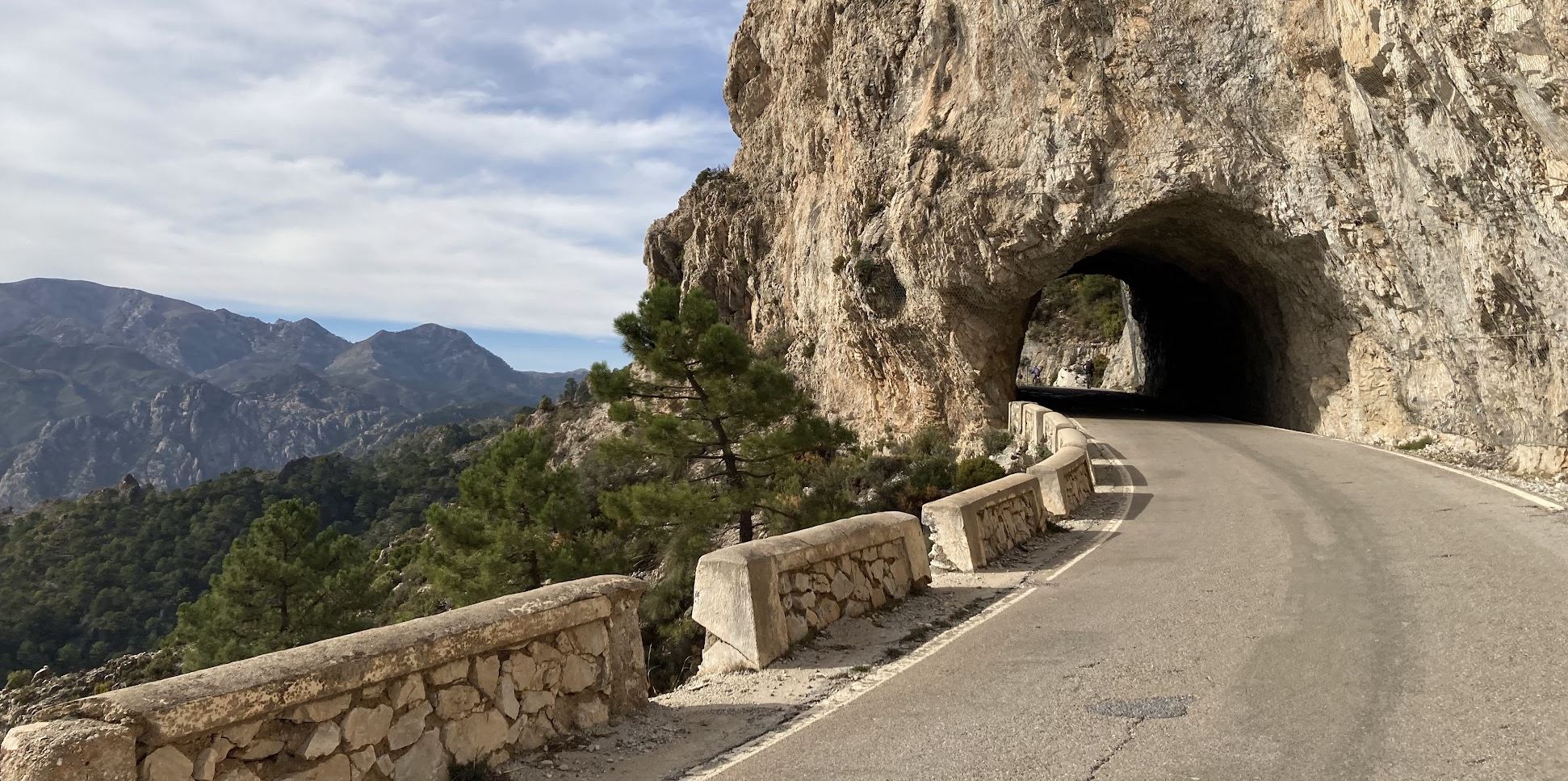
After a fantastic section with many switchbacks and more awesome views, there are a few easy kilometers with brief sections of descent. Near the end of the summit, there’s just a little more climbing to do. There even is a cute little tunnel of a mere 20 meters towards the end of the climb, which makes you forget about your legs for a bit.
The road keeps going on Granada, and there aren’t many other roads to take without making this a monster ride. The pros typically loop around the Sierra de las Tejeda, descending into the Axarquia valley via Zafarraya towards Almuñécar, up the Goat’s Path, and onwards to Granada. This makes almost 170 km, so unless you want to do that, the only realistic option is take the same road back to Almuñécar.
Fueling up
At the summit, there is Meson Los Prados strategically located where you can rest your weary legs and reflect on the climb that you’ve just done. Jete and Otívar might come a bit too soon in the climb to stop already, but they’re there with a few cafeterias.
Tips
Temperatures in Almuñécar may make you believe that you could head out with short sleeves. You’re heading towards one of the highest mountain ranges in Europe, so temperatures differences can be significant. Granada is scorching hot in summer, but it also can be freezing cold in winter. Recommended to do this one in Spring or Autumn.
