
Route Details
Steepest kilometre
The hardest continuous kilometre of Haza del Lino via Rubite, measured from the GPX track.
- Gradient
- 11.8% Savage
- Where
- km 16 - 17
- Rise
- +120m
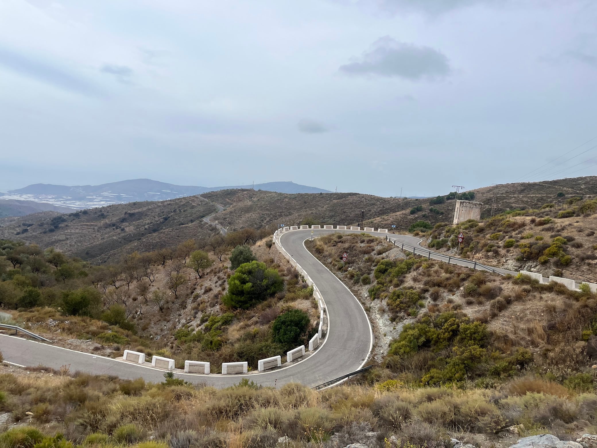
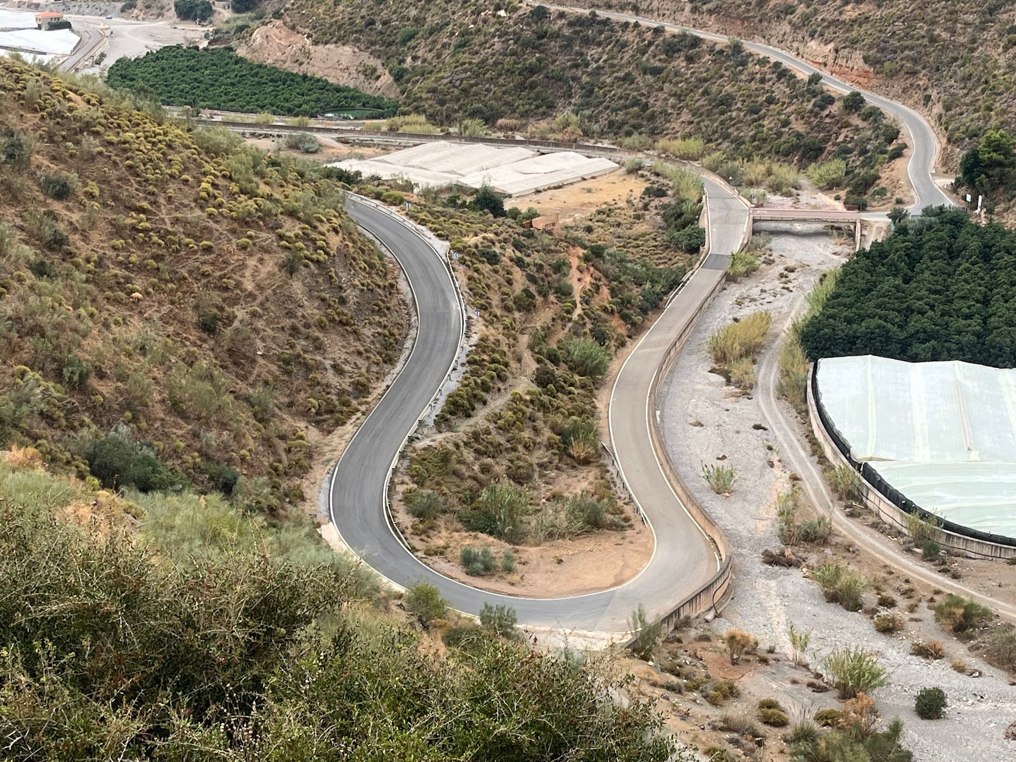
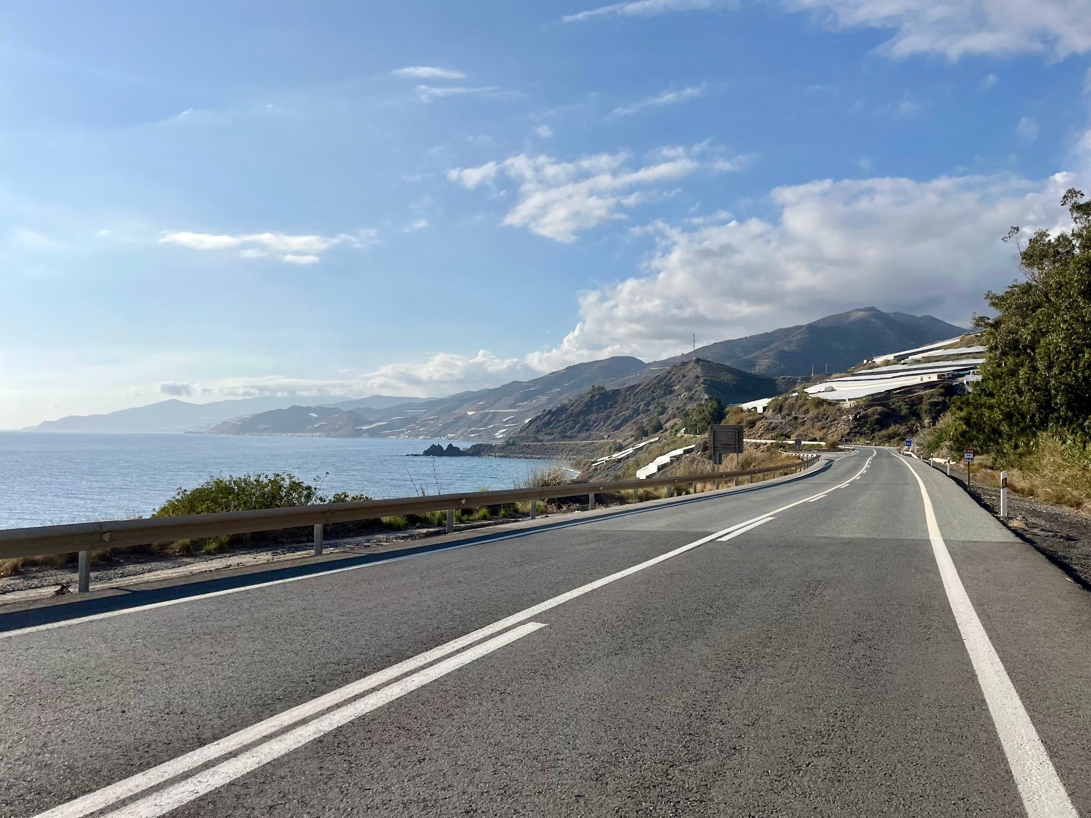
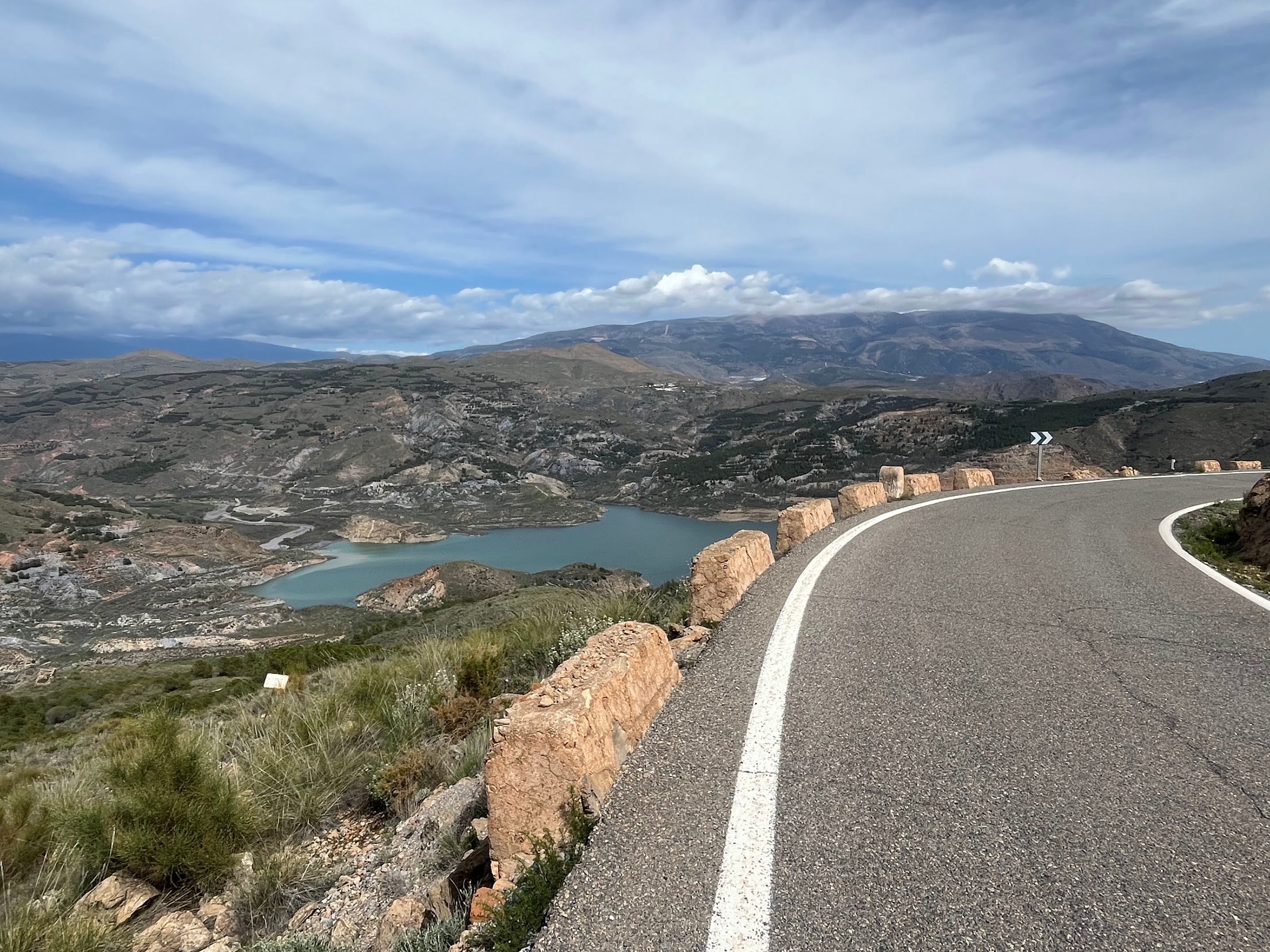
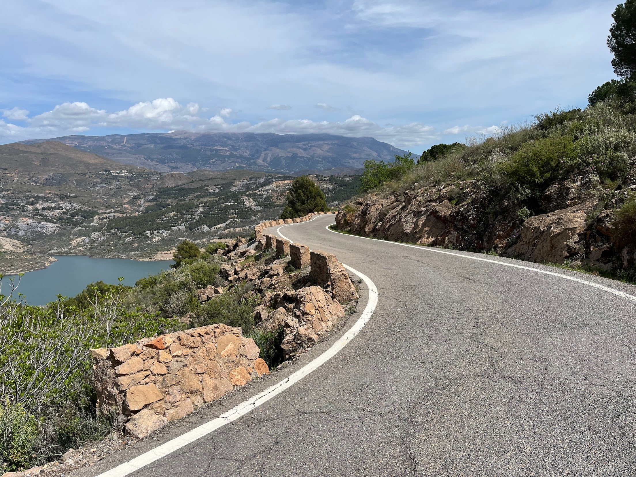
A 132 km loop from the coast up to Haza del Lino, the pass on the Contraviesa ridge, taken the hard way: through Rubite. There is a steadier way to the same summit - not an easier one, but one you can settle into a rhythm on - and if you have ridden the classic Haza del Lino loop you already know the view from the top. This is not that ride. Same mountain, 2,600 m of climbing, and a first half that takes the whole day away from you.
The climb is two climbs
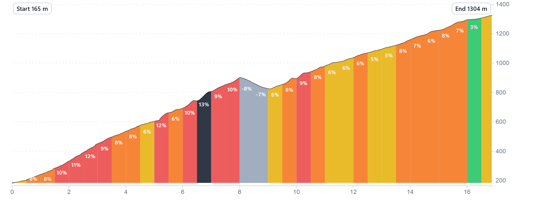
From the sea to the pass is 22 km and 1,304 m, but the average gradient of 6.5% tells you almost nothing useful. Split it at Rubite and it makes sense.
The lower half - the 8 km from roughly 165 m up to the village - averages 8.8%. Forty percent of it is steeper than 9%, and only two percent of it is shallower than 2%. There is no false flat, no shoulder, nowhere to freewheel for ten seconds and shake your legs out. Measured over 500 m windows the gradient swings between 3.7% and 12.8%, and it is that spread rather than the average that you actually feel: every time you find the right gear, the road has already changed its mind. The hardest kilometre averages 11.8%, the steepest 500 m hits 12.8%, and there is a 200 m section at over 19%.
By the time you reach Rubite you have climbed 865 of the day’s first 1,139 m - almost two thirds of the vertical in under half the distance. Depending on how well it is going, that is somewhere between fifty minutes and well over an hour of climbing, on top of the coastal approach. The road arrives at the village at 880 m, drops 73 m through it, and climbs back out at 6.8%. That descent is not a rest. It is ninety seconds of cooling legs and free altitude handed straight back.
Above Rubite the climb becomes a different animal: 7.8 km at 6.4%, with a 6 km stretch where the gradient never steps more than a percent at a time. On paper that is the easy half. In the legs it arrives an hour late.
The ridge keeps going
Reaching 1,304 m does not mean the climbing is done. The route spends the next 28 km on the Contraviesa between 1,168 and 1,354 m, with four more climbs and three descents strung along it - the true high point of the day is at km 43, well past the pass. It is the best riding on the loop, high and open with the Sierra Nevada on one side and the Mediterranean on the other, but it never gives you a flat ten minutes either.
The reward is one of the great descents in the province: 19 km and 871 m down off the ridge, the first genuine rest since the start.
Getting home
The last third is coastal, and the profile flatters it. After the long descent back to sea level the N-340 rolls rather than runs flat: there are five separate climbs of 20 m or more in the final 30 km, 239 m of climbing in total. Two bumps around km 111-115 put you back up at 100 m with ramps touching 7%, the road drops to the water again, and then a 90 m rise at up to 7.7% around km 119-121 with a last 8% kick behind it. None of them would register on a fresh day. They are not on a fresh day.
How to ride it
The whole day is decided in the 8 km below Rubite. Nothing above the village can rescue a lower half ridden too hard - but go in twenty or thirty watts under what feels right, accept losing time on the 11 and 12% ramps instead of matching them, and the upper half becomes a climb you can actually ride at tempo rather than survive. The difficulty is psychological as much as physical: that stretch never lets you forget you are holding back.
Start from the coast early. The lower slopes face the sea and bake from mid-morning, there is very little shade below the ridge, and the steepest kilometres are the ones where you are moving slowest and generating the most heat. Normal gearing is fine - this is not a climb that beats you on equipment. It beats you on condition. The ramps are steep but perfectly rideable; what decides the day is whether you have the fitness to absorb an hour of them and still ride the ridge afterwards.
You Might Also Like


Haza del Lino
Not yet discovered by the masses, this is a gem of a ride.


Ruta de la Cabra
The Goat's Path is an absolute beauty and must-do when you're in the area.


Sierra de Tejeda
One of the favorite loops of the pros when preparing for the Tour de France.
Read more
Articles covering this route, region, or country.

Top 5 cycling routes in Granada
Explore the best cycling routes in Granada. Snow-capped mountain climbs, empty valleys, butter-smooth roads, and historic cities are perfect for your next cycling holiday in Spain.

10 epic road rides in Andalucía
Discover 10 epic road cycling routes in Andalucía, Spain. Perfect for scenic rides, challenging climbs, and unforgettable cycling adventures.

Top 5 cycling routes in Málaga
Explore the best cycling routes in Málaga. Sunny coastal rides, mountain climbs, and scenic roads perfect for your next cycling holiday in Spain.