The route
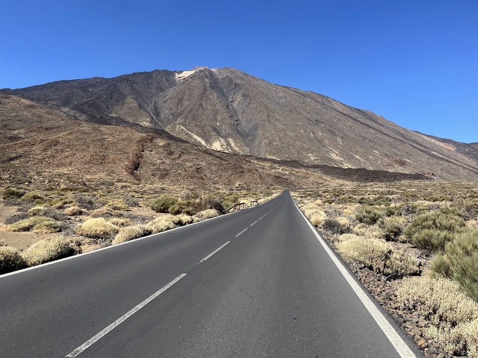
This is an ambitious route that explores the northern and western coasts of Tenerife before tackling the spectacular climb to the village of Masca. At 101km with 2,484m of elevation gain, this is a substantial 5-6 hour ride that demands good fitness and preparation.
The route leaves from Puerto de la Cruz and takes you through the northern coastal towns of Icod de los Vinos and Buenavista del Norte as you ride towards the south. Enjoy riding and discovering the northern coast along the way, though be prepared for the inevitable heavy traffic that plagues this island.
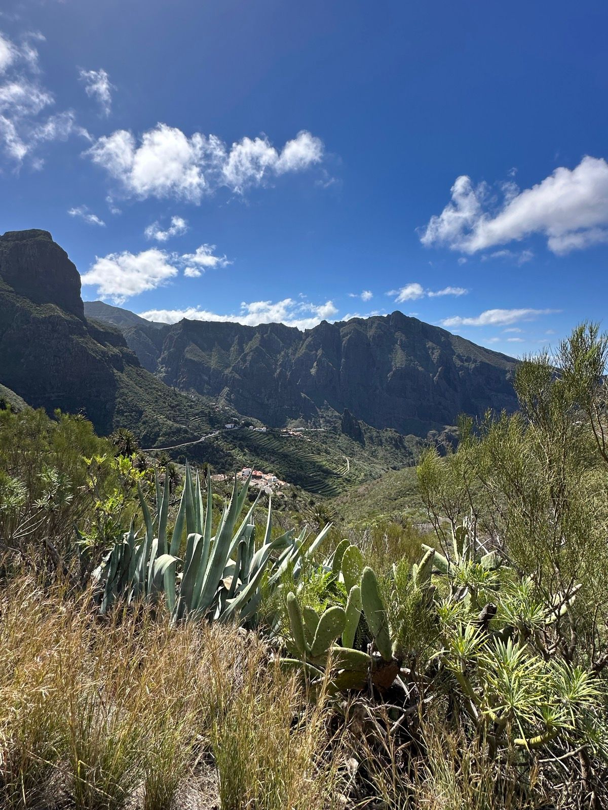
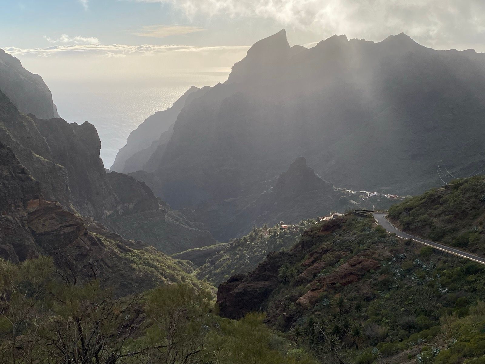
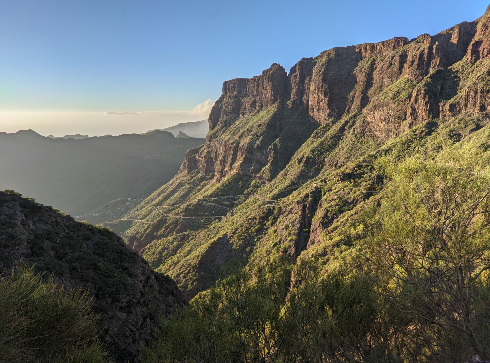
From Buenavista del Norte, you have two options to reach Masca. You can take the more scenic coastal route continuing west, or alternatively head inland via El Tanque and Santiago del Teide. Both routes eventually converge before the final spectacular ascent to Masca, one of Tenerife’s most beautiful and remote villages, perched dramatically in the mountains.
NOTE
I drove part of this route years ago, and Masca is a place that stuck with me. It’s absolutely beautiful and the roads are steep and dramatic. But I also remember the traffic - even back then, there were too many cars on roads that simply aren’t built for it.
When I planned this cycling route for this trip, I was excited to experience it on a bike. But ultimately, I didn’t ride it. The traffic situation in Tenerife has only gotten worse, and the thought of riding these narrow mountain roads with endless streams of rental cars and tourist buses was too much. Sometimes you have to accept when a place just isn’t safe to cycle anymore.
If you do attempt this route, consider arranging car support from Santiago del Teide as a bailout option - 101km with 2,484m of climbing in these conditions is no joke.
Fueling up
Stock up well in Puerto de la Cruz before you start. You’ll pass through Icod de los Vinos and Buenavista del Norte where you can find cafes and restaurants for refreshments. Santiago del Teide also has provisions if you take the inland route.
At 101km with 2,484m of climbing over 5-6 hours, this is a substantial undertaking. Carry ample water and energy supplies. The climb to Masca itself is remote with limited services, so plan your nutrition carefully. As with other Tenerife routes, bring cash as fuentes are scarce.
Tips
Safety first: As mentioned in the warning section on the Tenerife starting page, traffic is insane on this island, not in small part caused by the endless hordes of irresponsible and reckless tourists. This route covers some of the busiest tourist roads on the island. Make sure to be as visible as possible with reflective gear and lights, and keep your wits about you. When - not if - a mad person does something incredibly dangerous, you need to be ready to react.
This is a substantial day out with 2,484m of climbing. Start very early to avoid the heat and give yourself plenty of time. Consider arranging car support or having a bailout plan from Santiago del Teide if things don’t go according to plan.
The climb to Masca is stunning but demanding. Pace yourself carefully given the total elevation gain. Check weather conditions before setting out, as conditions can change rapidly in the mountains. Bring multiple bottles and plan your refueling stops carefully - this is not a route where you want to bonk.
You Might Also Like


Teide from Puerto de la Cruz (via Santiago del Teide)
An epic route climbing Mount Teide and returning via the scenic western route to Puerto de la Cruz.


Teide from Puerto de la Cruz (via La Esperanza)
Climb Mount Teide first, then descend northeast and turn off at La Esperanza to head back to Puerto de la Cruz.


Punta del Hidalgo
A scenic coastal route to Punta del Hidalgo, offering beautiful ocean views and a more relaxed cycling experience.
Read more
Articles covering this route, region, or country.

10 epic road rides in Andalucía
Discover 10 epic road cycling routes in Andalucía, Spain. Perfect for scenic rides, challenging climbs, and unforgettable cycling adventures.

Top 5 cycling routes in Granada
Explore the best cycling routes in Granada. Snow-capped mountain climbs, empty valleys, butter-smooth roads, and historic cities are perfect for your next cycling holiday in Spain.

Top 5 cycling routes in Málaga
Explore the best cycling routes in Málaga. Sunny coastal rides, mountain climbs, and scenic roads perfect for your next cycling holiday in Spain.