
A 110 km gravel loop just north of Sevilla, stitching together sections of two well-known local ways: the Ruta Vía de la Plata and the Ruta del Agua. Both are well-trodden. The surface in places less so.
It’s gravel, it’s rolling, and it’s properly remote in places. Bring everything you’d take on a long day out: spares, water, food, and patience for the inevitable rough sections.
The Vía de la Plata
The Vía de la Plata is one of Spain’s oldest roads, predating the Romans and later paved by them. The name comes from the Arabic for “paved”, not from silver. The original Roman line ran from Mérida north to Astorga; the modern version stretches from Sevilla all the way to Gijón, roughly 1,000 km of it.
Today it’s most famous as an alternative Camino de Santiago route. Pilgrims walk and cycle north from Sevilla, peeling off west toward Compostela when they hit the Camino Francés. That’s a big part of why the southern stages are so well-trodden, signposted, and serviced with food and lodging along the way.
The Ruta del Agua
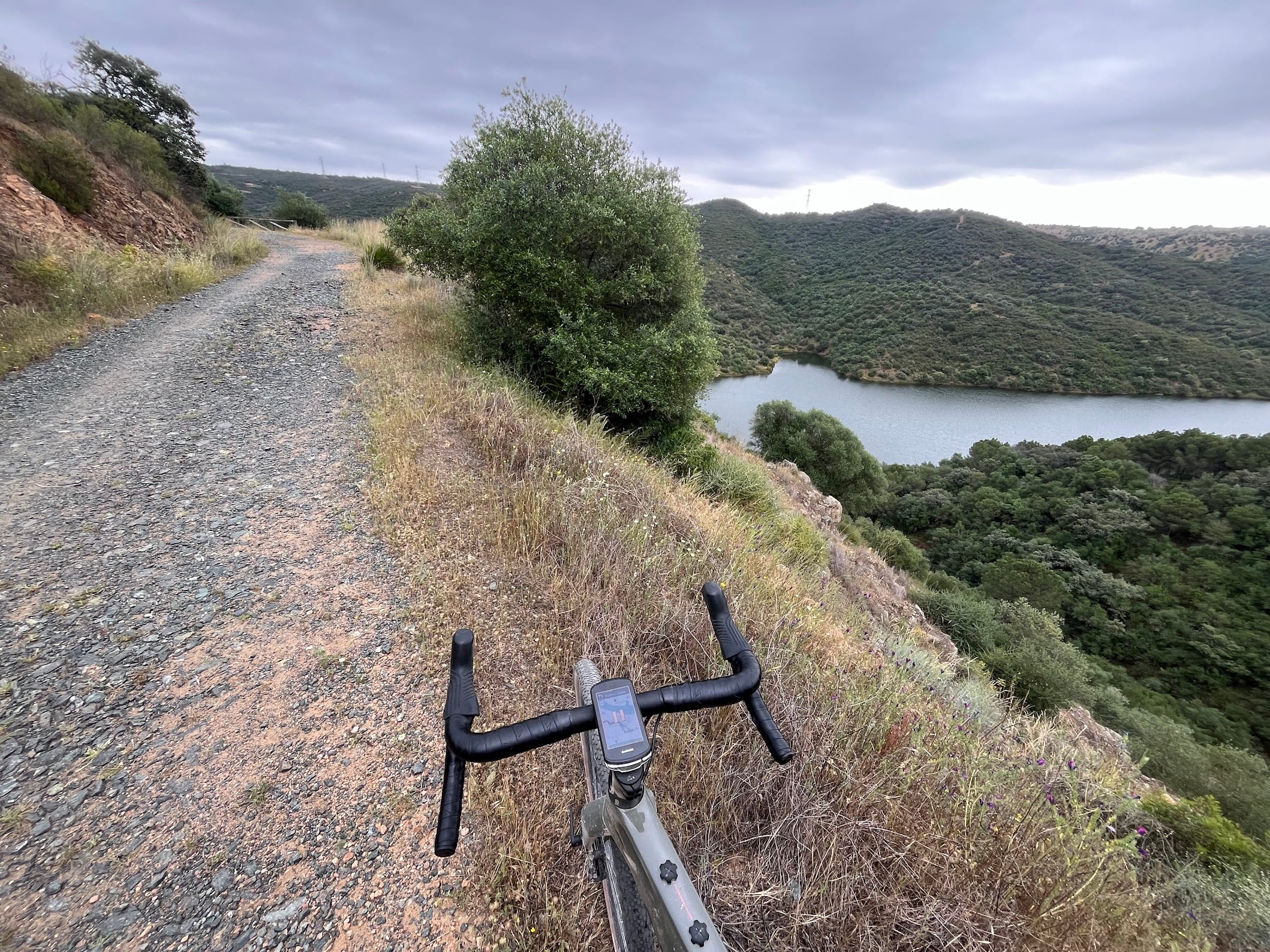
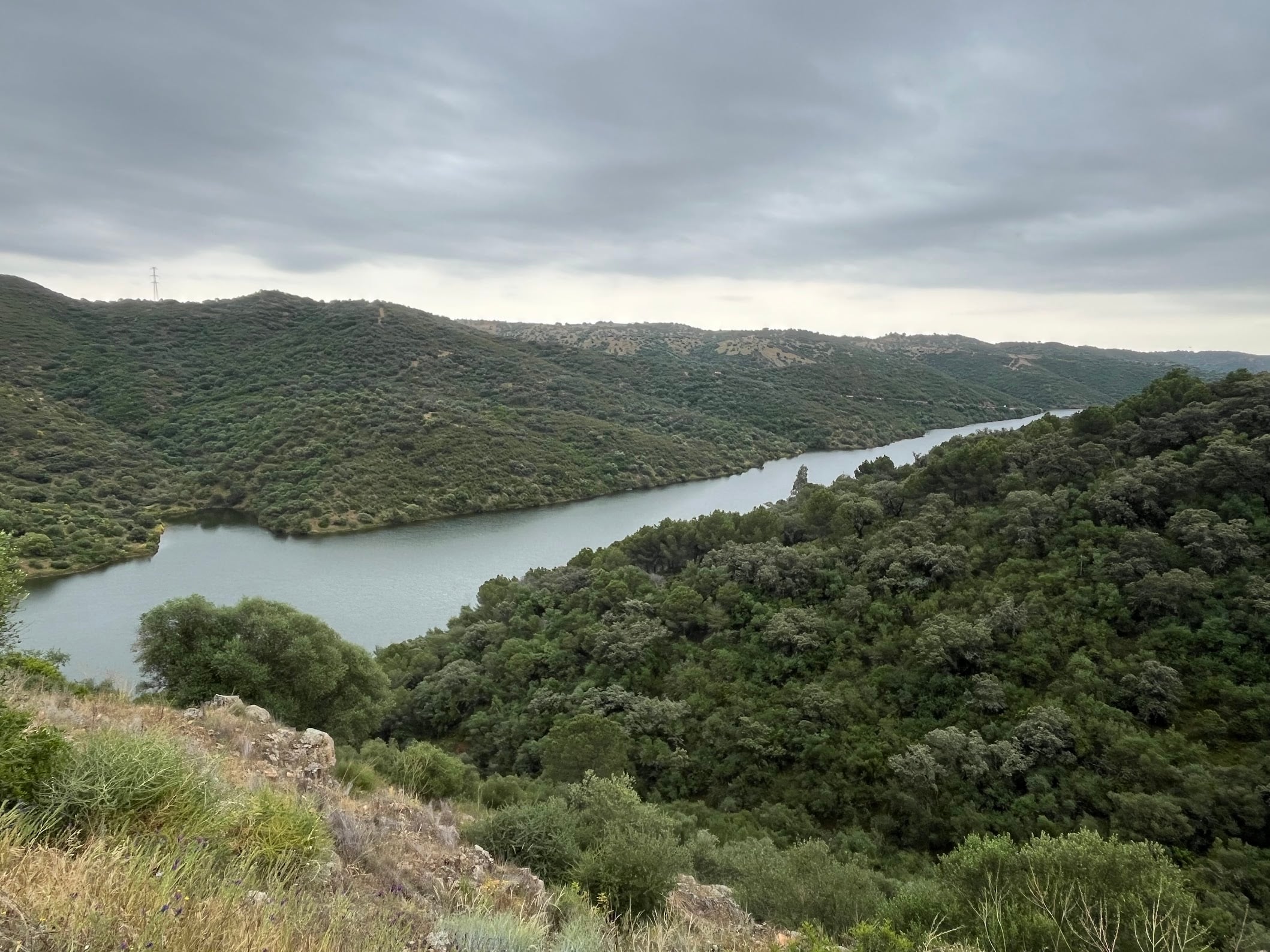
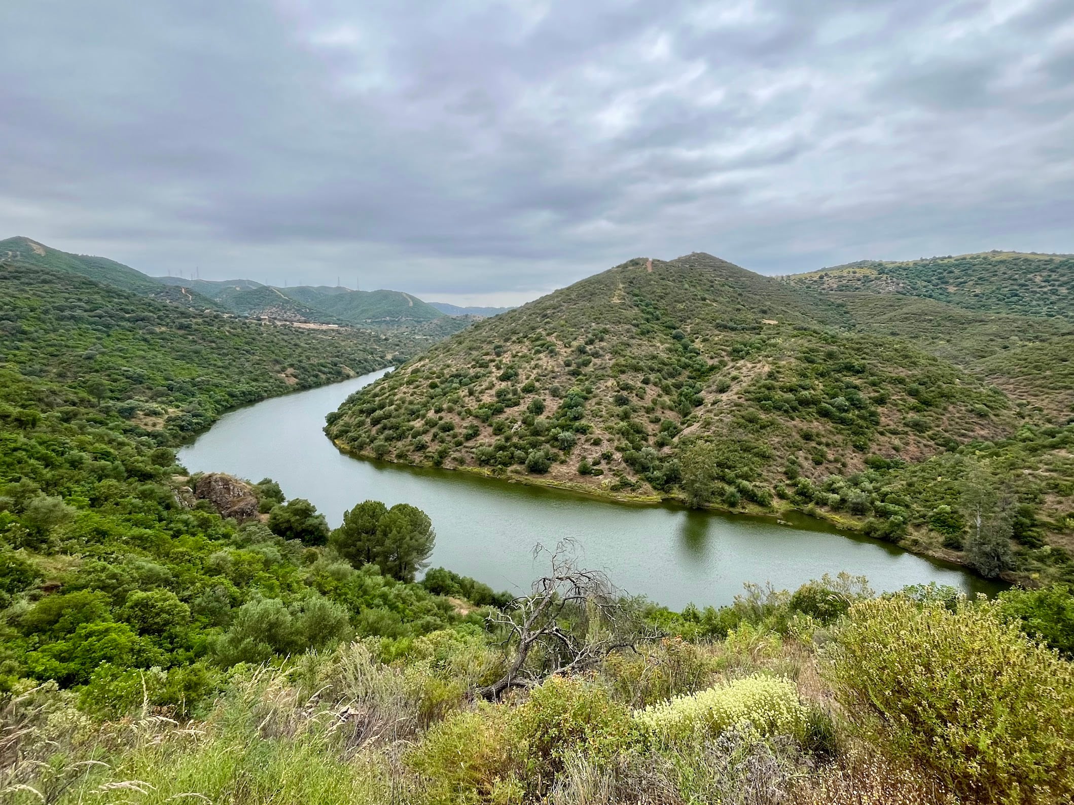
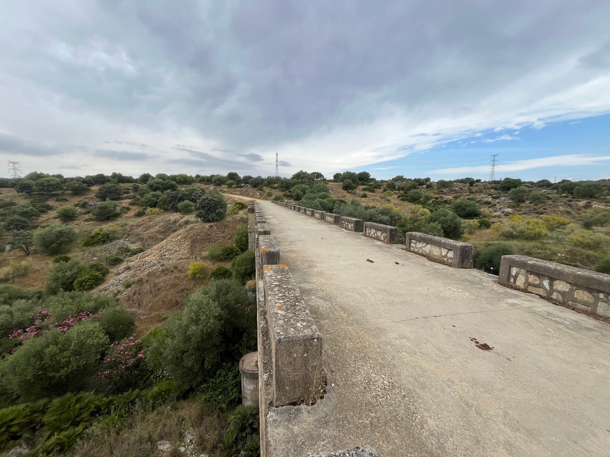
The Ruta del Agua is a more local affair: a roughly 68 km gravel and MTB route through the foothills of the Sierra Morena, in and around Guillena, just 20 km north of Sevilla. It threads past the El Gergal and Cala reservoirs (the “agua” of the name), with old railway stations, prehistoric sites, and even a 19th-century mock-medieval palace, the Palacio de Parladé, dotted along the way.
It’s a favourite of the local gravel and MTB scene, and genuinely good riding. Just rougher in places than the Vía de la Plata.
Italica
On the way out from Sevilla, the route passes close to Italica, one of the most important Roman sites in Spain. Founded in 206 BC, it was the birthplace of the emperors Trajan and Hadrian, and its amphitheatre is still standing. Worth a quick stop if you’ve got time, or a proper visit on a different day.
What to expect
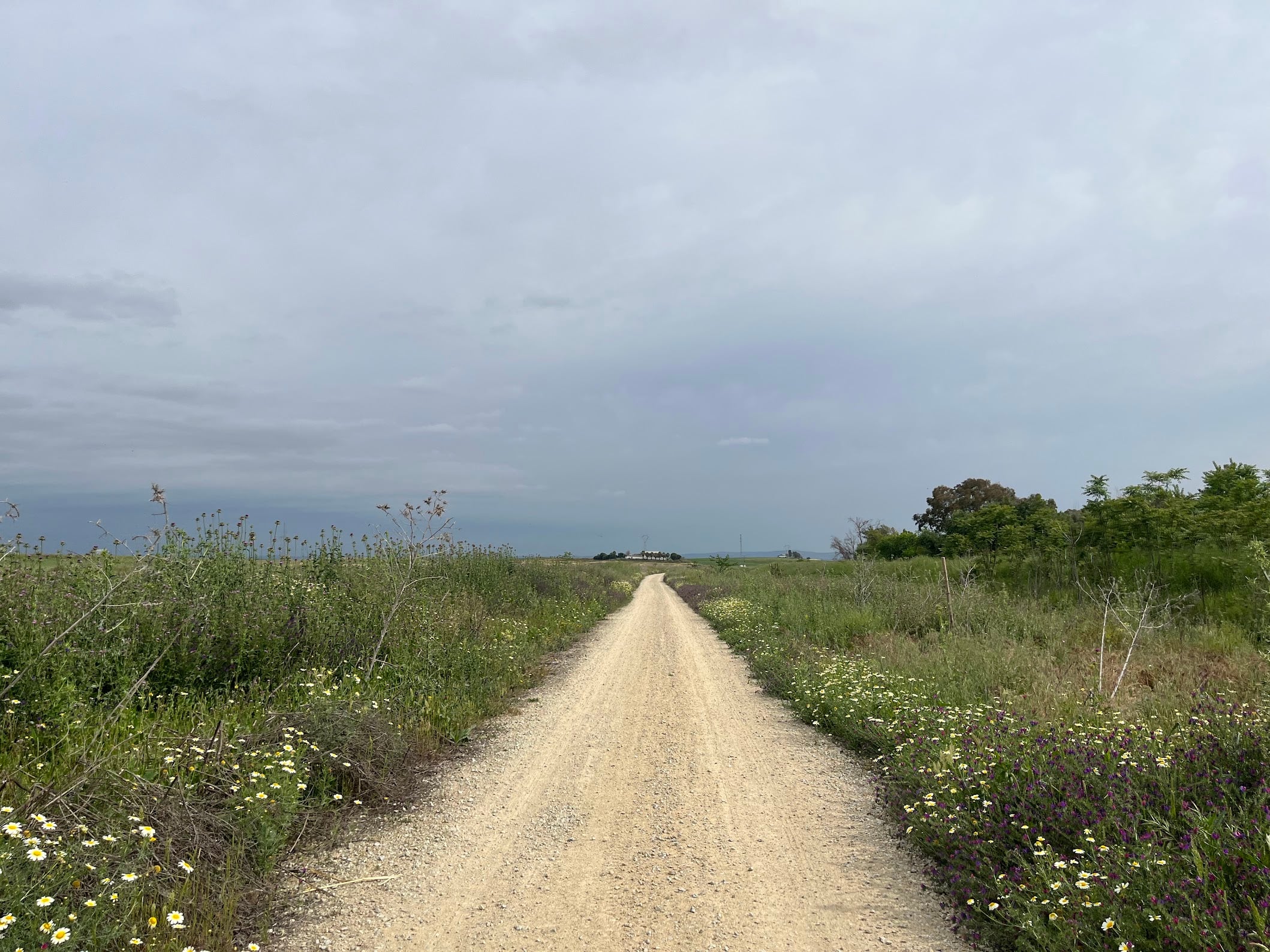
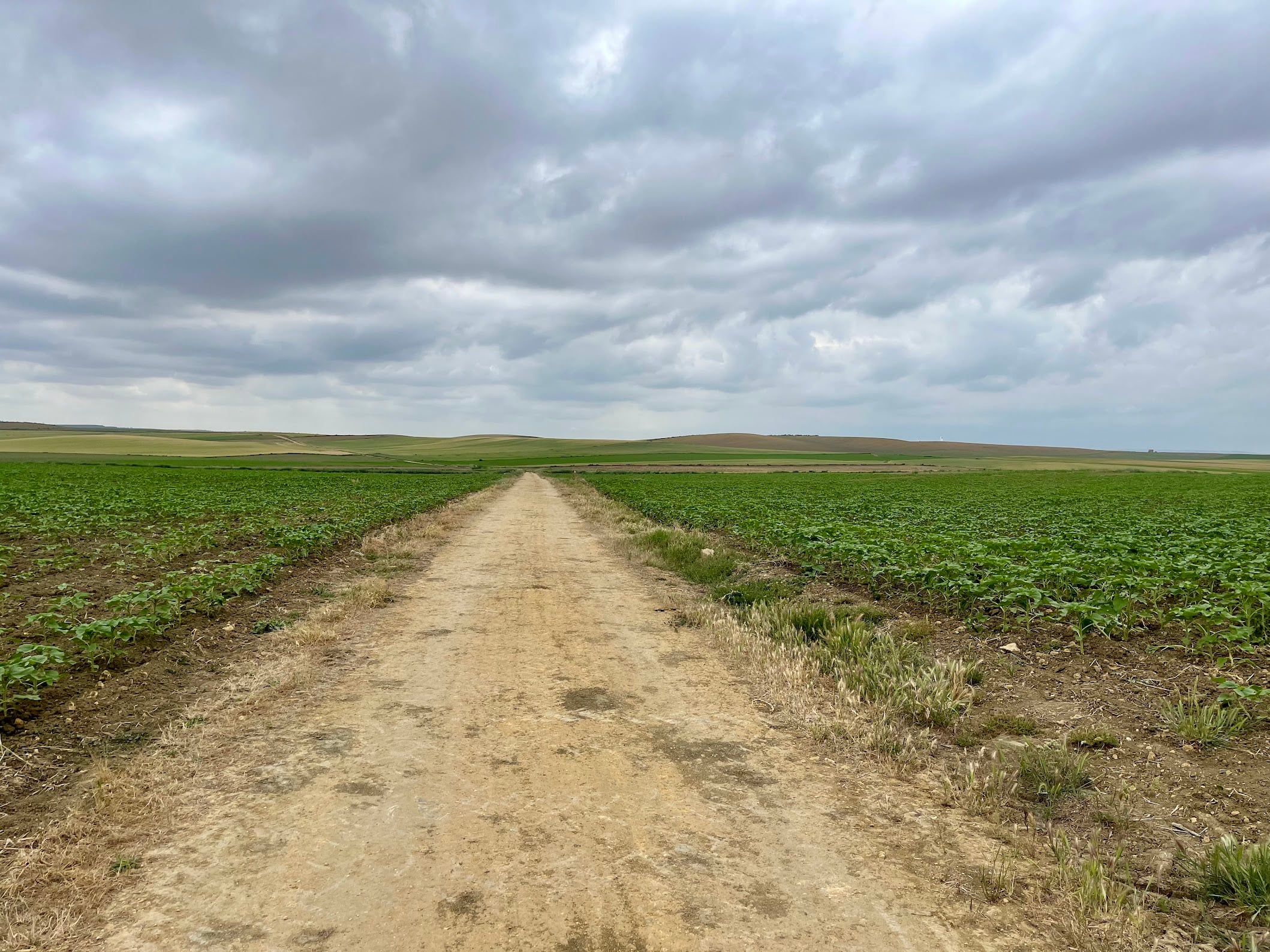
The terrain is mostly hardpack gravel, drovers’ tracks, and quiet country lanes. There are no monster climbs but the rolling is constant, and the gravel surface adds enough friction that the distance feels longer than the numbers suggest.
What really stings is the state of the surface in places. Especially towards the end of the loop, the tracks get rough: potholes, embedded rocks, and sharp gravel that hammers your hands and backside for kilometres on end. By the time you roll back into Sevilla you’ll know about it.
The two named routes (Vía de la Plata and Ruta del Agua) are well known locally and reasonably well signposted, but always carry the GPX as a backup.
Fueling
Inland Andalucía is sparsely populated. Plan stops at the villages you pass through rather than assuming you’ll find anything in between. Carry more water than you think you need, especially in shoulder season when daytime temperatures can still hit 30°C+.
When to ride
Spring and autumn. Summer here is genuinely dangerous heat. Winter is rideable but the gravel turns to mud after rain and the days are short.
You Might Also Like


Calar Alto
Epic climb to the otherworldly Calar Alto Observatory.


Alto de Velefique
The Spanish equivalent of Alpe d'Huez.

Velefique & Collado del Ramal
A brutal desert double-header linking Alto de Velefique with the savage Collado del Ramal.
Read more
Articles covering this route, region, or country.
10 epic road rides in Andalucía
Discover 10 epic road cycling routes in Andalucía, Spain. Perfect for scenic rides, challenging climbs, and unforgettable cycling adventures.

Top 5 cycling routes in Granada
Explore the best cycling routes in Granada. Snow-capped mountain climbs, empty valleys, butter-smooth roads, and historic cities are perfect for your next cycling holiday in Spain.

Top 5 cycling routes in Málaga
Explore the best cycling routes in Málaga. Sunny coastal rides, mountain climbs, and scenic roads perfect for your next cycling holiday in Spain.