This route starts in the hamlet of Trapiche, nestled among the avocado and mango groves of the Axarquía region. However, you could start anywhere, as the journey mostly follows the coastal road.
The ride heads eastward along the N-340 towards popular tourist destinations such as Torrox Costa and Nerja. Despite being the only supposedly flat road in the province, it’s often undulating with the occasional climb of a coastal cliff, adding character to the terrain. And the wind always seems to blow in the wrong direction. They used to call this place Costa del Viento for a reason, before some marketing genius rebranded it the Costa del Sol.
If - and it’s rare these days - there’s little traffic, these roads are glorious and views of the Mediteranean are spectacular, making the effort more than worthwhile.
The route eventually leads into Nerja, a charming seaside town known for its picturesque balconies and views over the sea. A short detour to the Balcón de Europa offers a rewarding photo opportunity before beginning the main climb of the day.
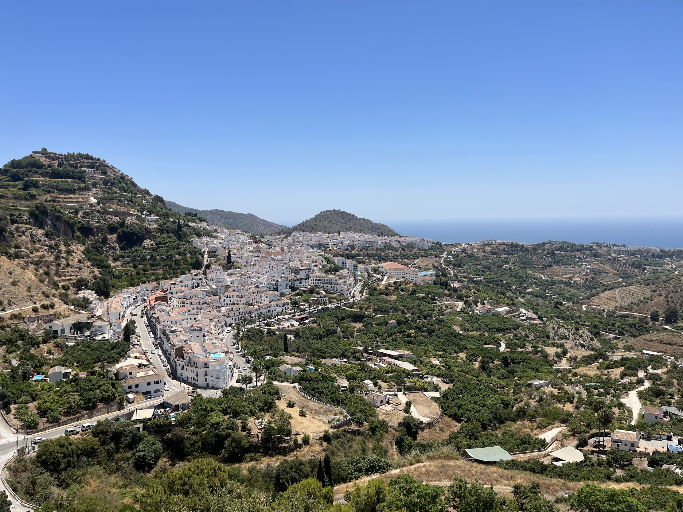
Leaving the coast behind, cyclists ascend the well-paved MA-5105 toward Frigiliana, a beautiful whitewashed village perched on the hillside. This climb packs some punch with a few hard sections that easily go into the double digits. It’s a busy and narrow road with plenty of blind corners, which locals (and tourists, unknowingly) are more than happy to use to overtake cyclists at tremendous speed.
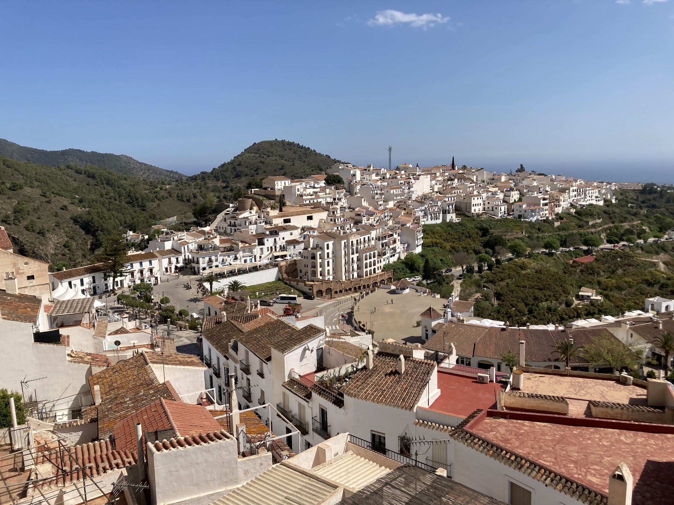
Upon reaching Frigiliana, a short rest is well-earned. The village’s cobbled streets and mountain views make it a highlight of the route.
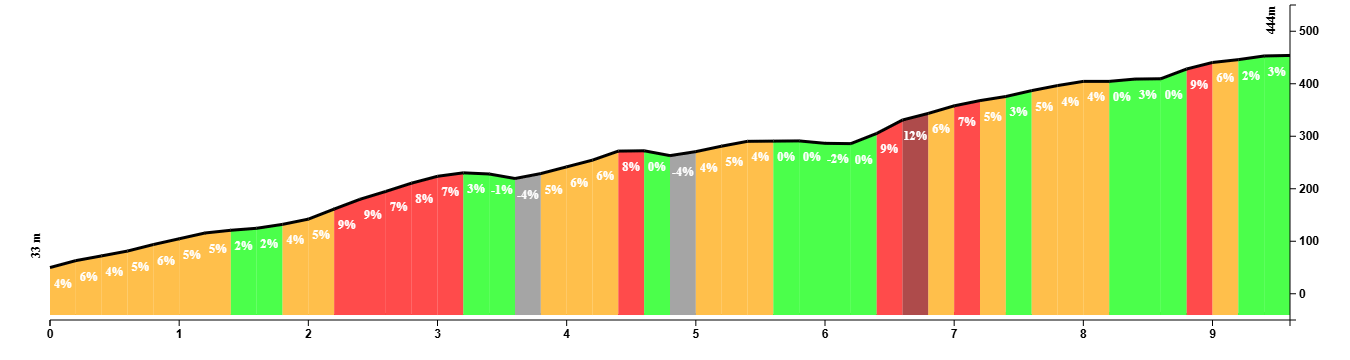
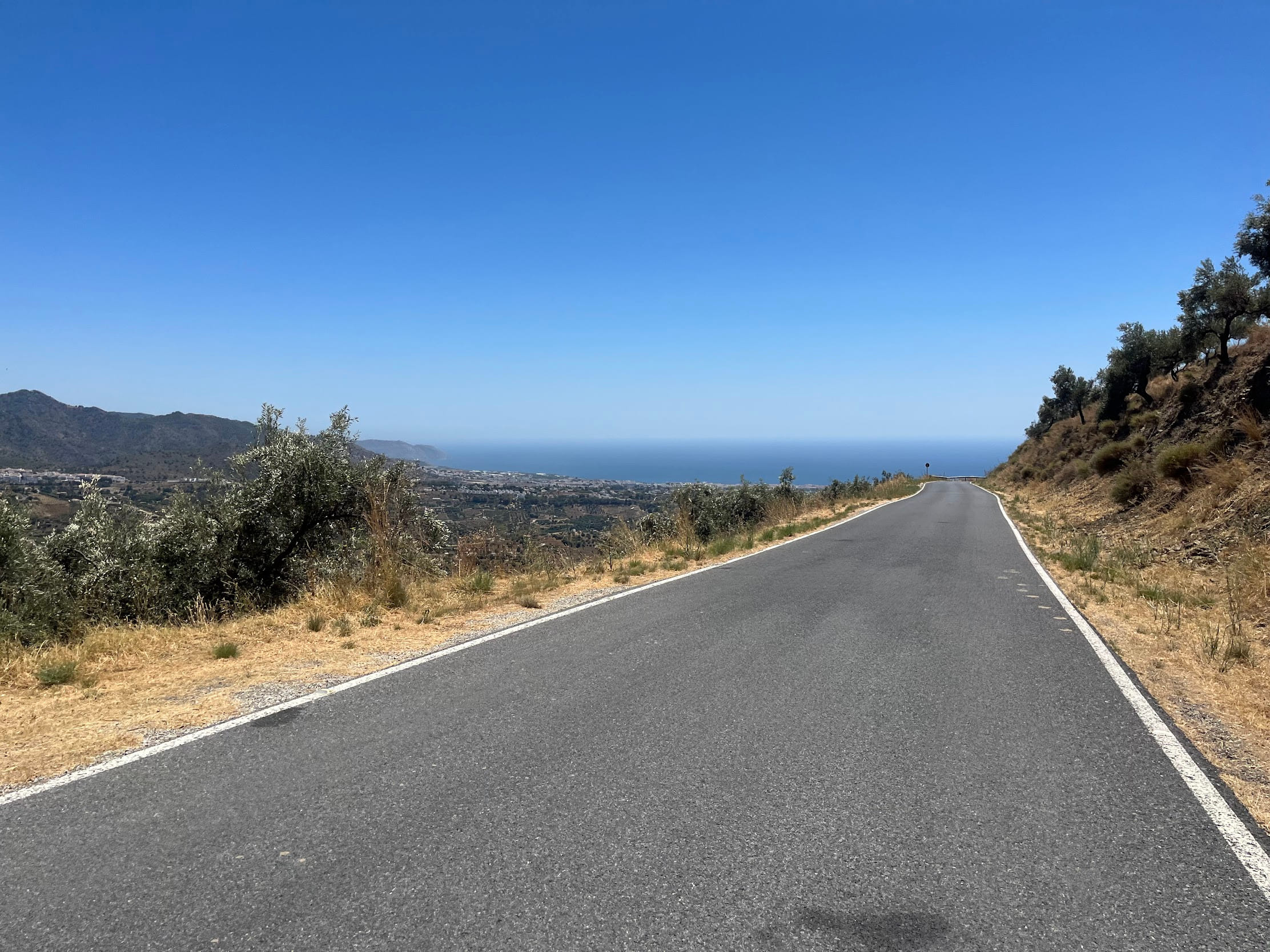
The most difficult part comes when you leave Frigliana at the final roundabout. It’s only a mere 300 meters, but it takes a while before you’re rewarded with a scenic viewpoint over the village and the coastline. The ride then continues inland via MA-5104, where the terrain becomes more undulating. This section is quieter, with less traffic, and offers a taste of the rural Axarquía region -marked by rolling hills, vineyards, exotic fruit and olive trees, and traditional cortijos.
The route eventually leads to Torrox Pueblo, another picturesque village with narrow, winding streets and traditional Andalusian charm. From Torrox Pueblo, the route descends back to the coast at Torrox Costa, rejoining the familiar N-340 for the return leg westward.
The final stretch retraces the coastal road through places like Lagos, Mezquitilla and Torre del Mar before gently climbing inland to finish at Trapiche.
You Might Also Like


The classic loop: Puerto del León
A punchy ride through the Montes de Málaga with more than 1000m of elevation gain in less than 50 km.


Casabarmeja - Colmenar
The road of the 1000 turns to Casabermeja is the perfect training climb.


Almogía - Villanueva
A wonderful loop of the Embalse de Casasola.
Read more
Articles covering this route, region, or country.

Top 5 cycling routes in Málaga
Explore the best cycling routes in Málaga. Sunny coastal rides, mountain climbs, and scenic roads perfect for your next cycling holiday in Spain.

10 epic road rides in Andalucía
Discover 10 epic road cycling routes in Andalucía, Spain. Perfect for scenic rides, challenging climbs, and unforgettable cycling adventures.

Top 5 cycling routes in Granada
Explore the best cycling routes in Granada. Snow-capped mountain climbs, empty valleys, butter-smooth roads, and historic cities are perfect for your next cycling holiday in Spain.