The second-most iconic climb (Alto de Velefique is hard to beat!) in the Tabernas desert must be Calar Alto. This is an observatory that singlehandedly gives this place an otherwordly feel in an already unreal place in the desert of Tabernas.
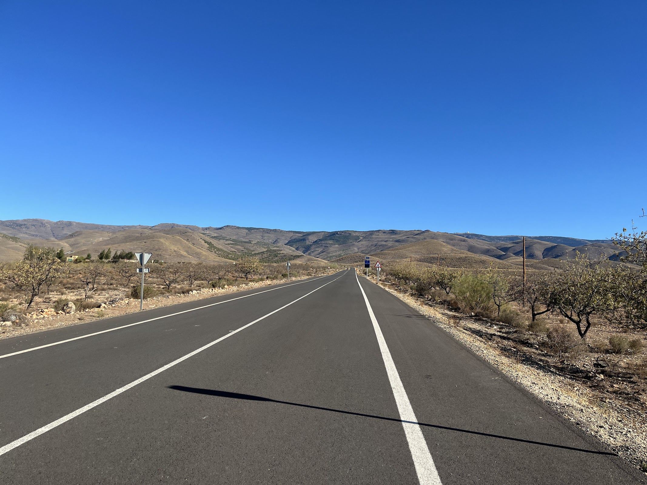
The climbing starts in the tiny village of Gérgal. The climb is about 25 km long, and while never steep, it’s not the easy climb you expect it to be when you look at the climb profile.
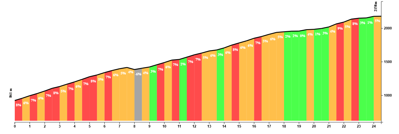
The first part is quite tough but gradually eases off. Roads are decent on this side (the same can’t be said from the other side), but they get worse as you get closer to the top.
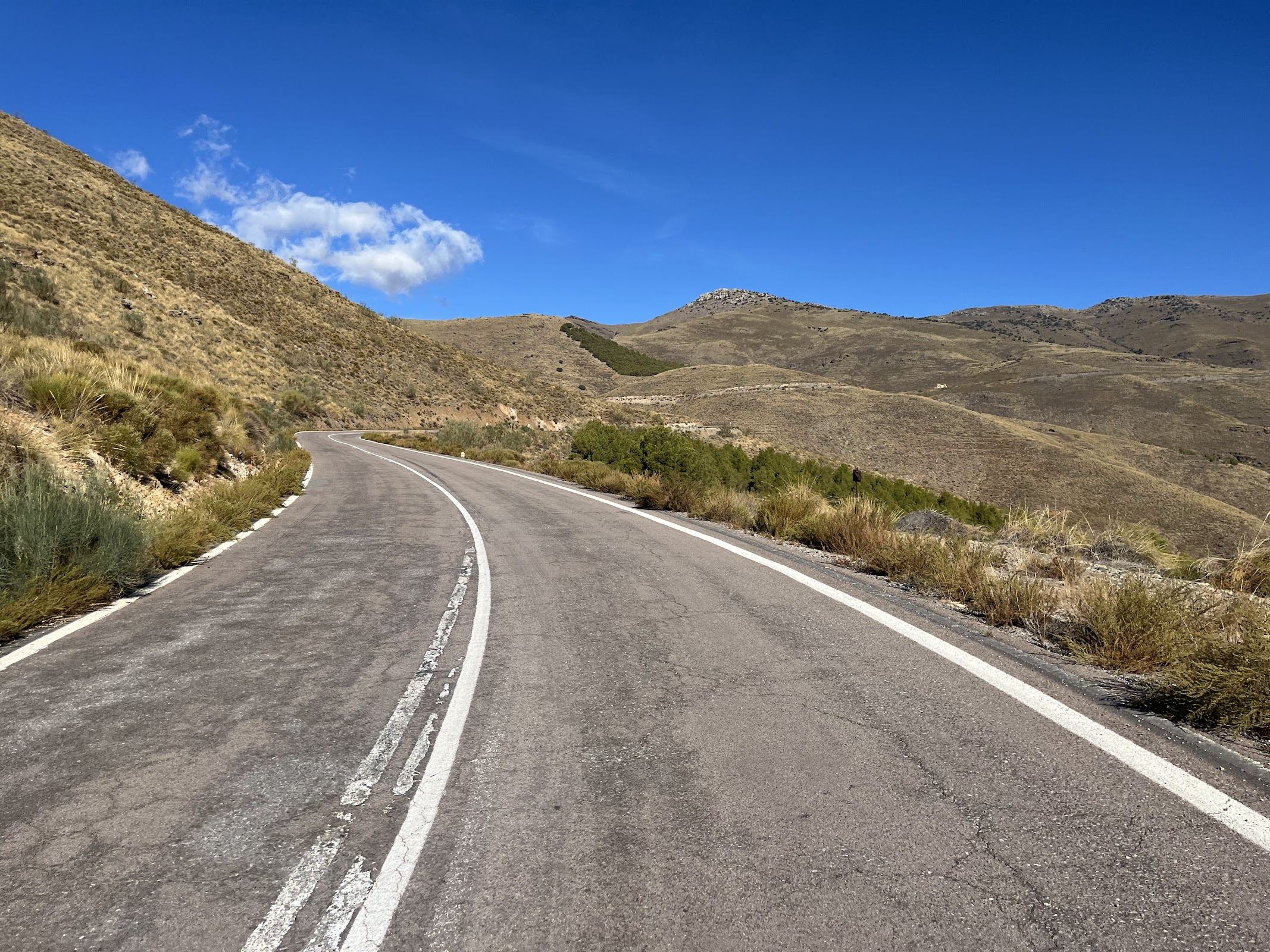
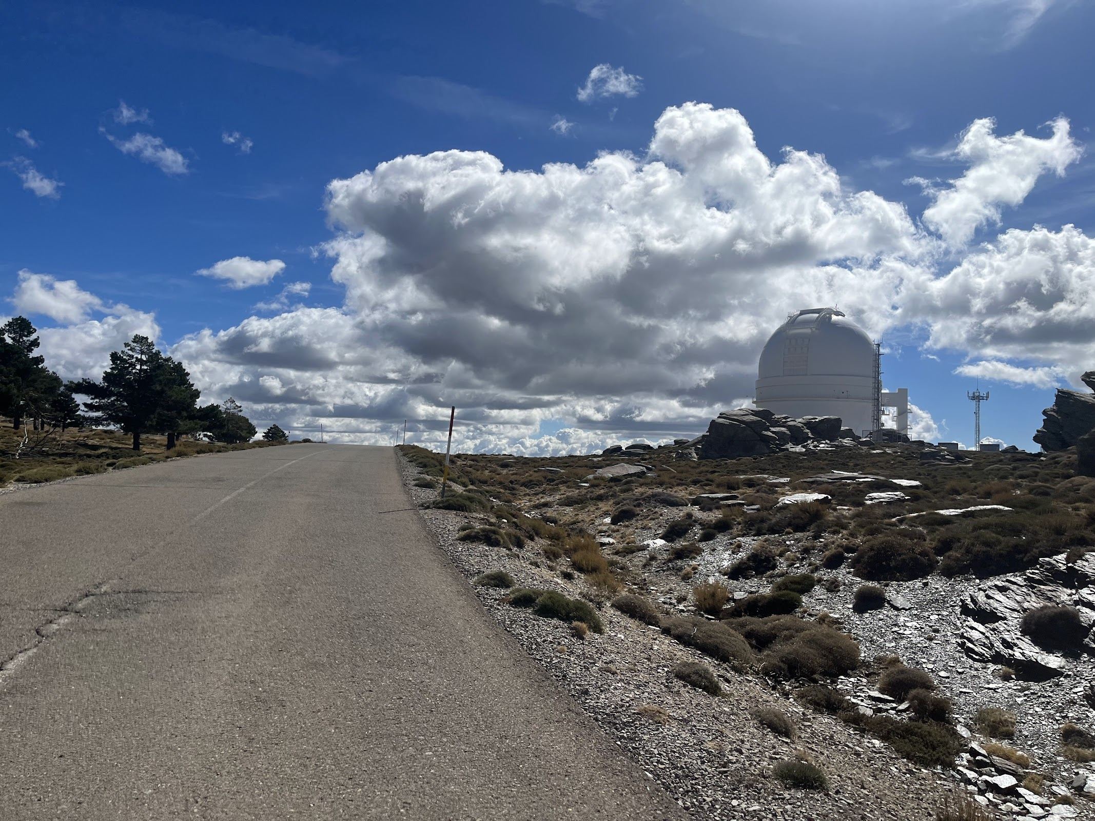
The road just keeps going and there never seems to be any sign of the summit. Only one 1 or two places can you actually see the domes of the observatory, but then you still have a long way to go.
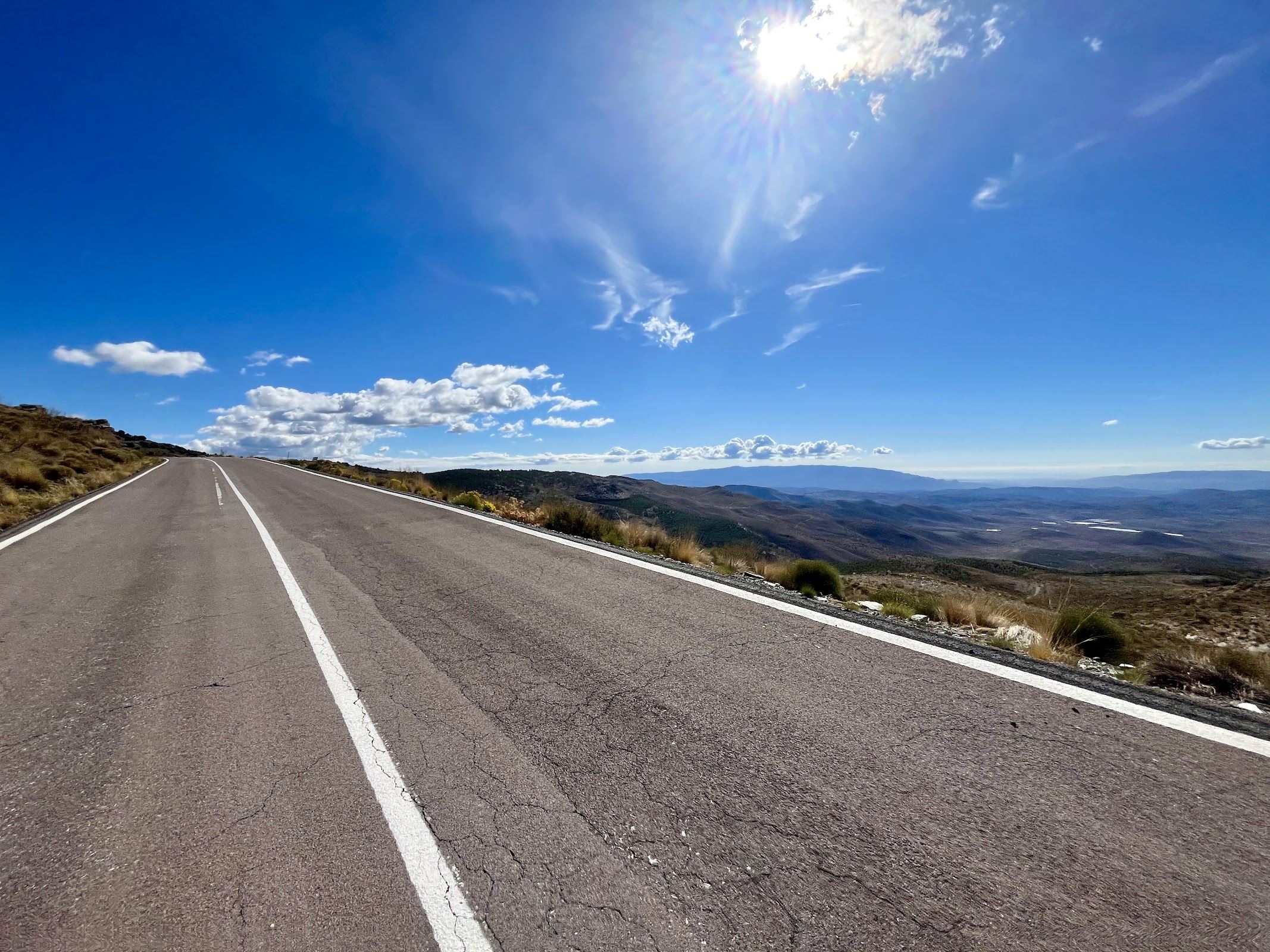
And when you think you’re at the summit, you enter a forested area on a plateau, and you’re still climbing, even above the 2,000m altitude mark. At the end are a couple of nasty stretches uphill; nothing really bad but your legs will probably start to hurt by now.
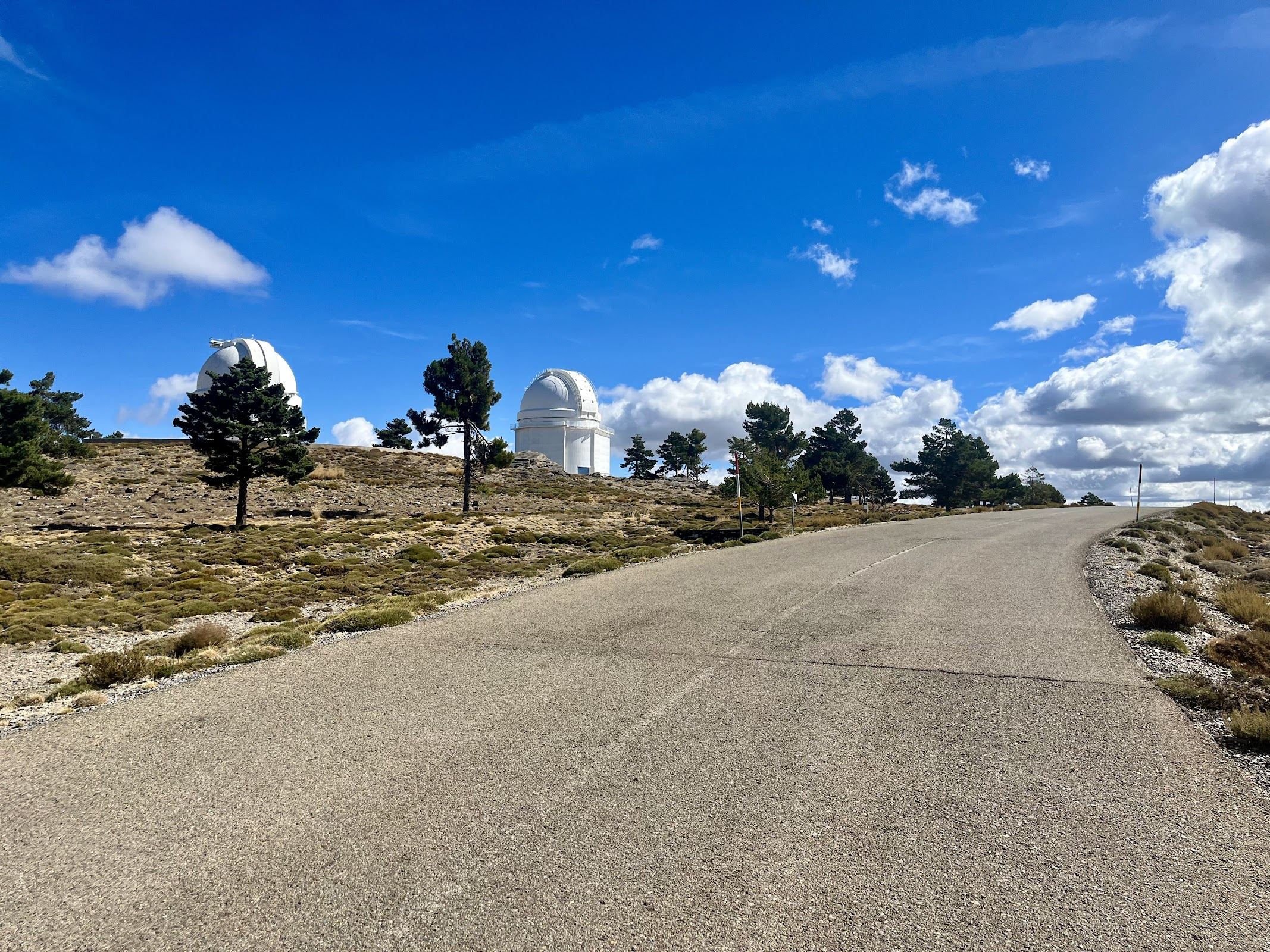
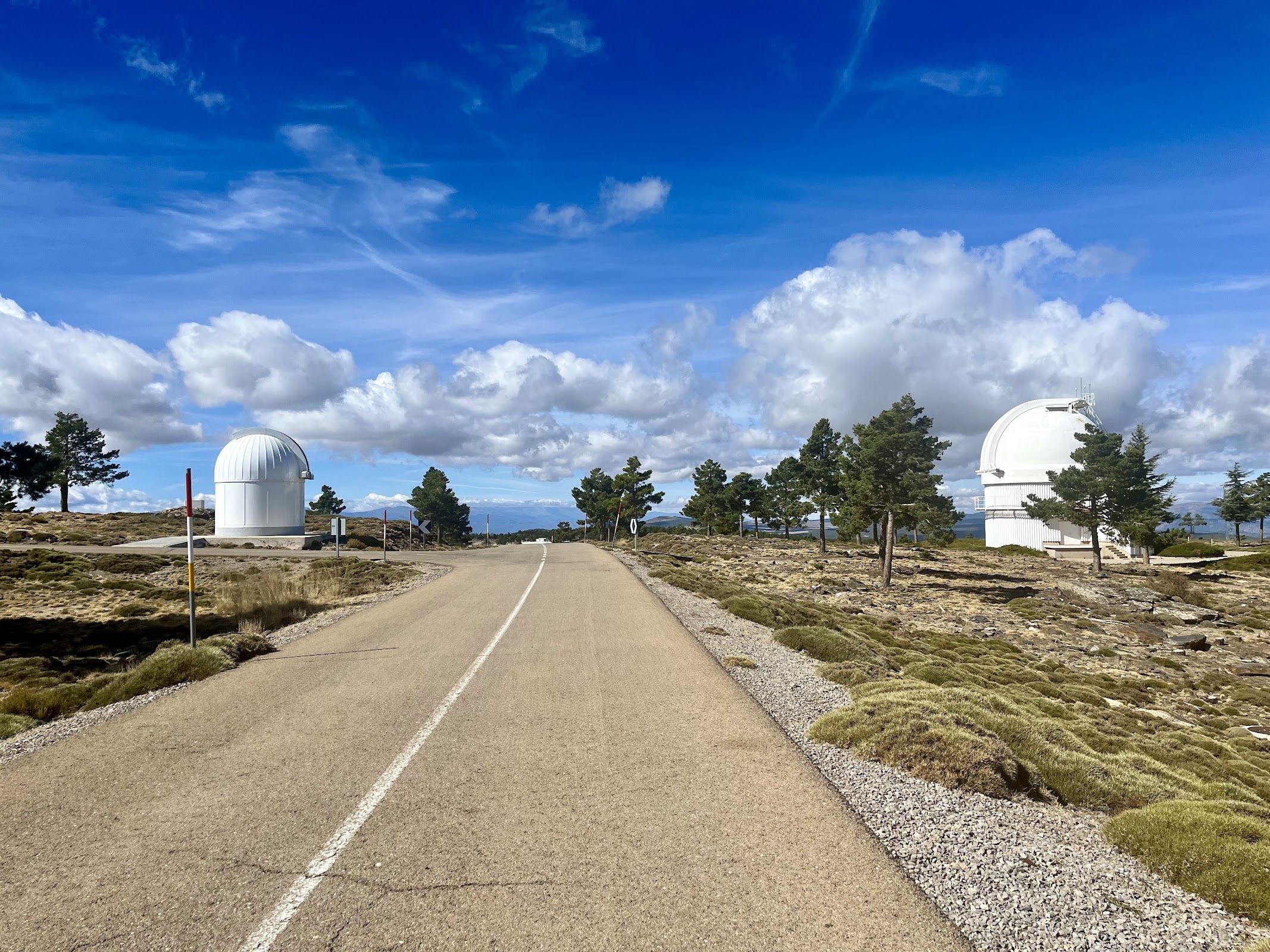
And then, almost out of nowhere, you see the majestic domes of the observatory in an otherwordly landscape. It really is something special, this place. After riding around the domes for a little bit, it’s time to fly down the other side of the mountain, which is definitely the harder (but shorter) side.
If you’re keen, you can inverse the route, and begin with the climb of the Alto de Velefique, ride to Bacares, and head to the Calar Alto, to descend down the western flank of the mountain. Monster ride or not, this is a really cool ride that’s worth the trip to this remote area.
Fueling
You’re in the desert, so don’t expect many places to rest. Gérgal has a few places where you could stop for a drink and a bite. Unless I’m mistaken, Aulago, a village on route, does not have a cafeteria. It had a restaurant, but that seems to be closed now.
You Might Also Like


Alto de Velefique
The Spanish equivalent of Alpe d'Huez.

Velefique & Collado del Ramal
A brutal desert double-header linking Alto de Velefique with the savage Collado del Ramal.


Mojácar
A low-key ride through the Almerían desert.
Read more
Articles covering this route, region, or country.
10 epic road rides in Andalucía
Discover 10 epic road cycling routes in Andalucía, Spain. Perfect for scenic rides, challenging climbs, and unforgettable cycling adventures.

Top 5 cycling routes in Granada
Explore the best cycling routes in Granada. Snow-capped mountain climbs, empty valleys, butter-smooth roads, and historic cities are perfect for your next cycling holiday in Spain.

Top 5 cycling routes in Málaga
Explore the best cycling routes in Málaga. Sunny coastal rides, mountain climbs, and scenic roads perfect for your next cycling holiday in Spain.