Vía Verde de la Axarquía
One of the best routes you can do by mountainbike or gravel bike in the comarca of Axarquía is this wonderful loop through the natural park of Sierras de Tejeda, Almijara y Alhama, the emblematic Boquete de Zafarraya, and the piece the resistance: the old train track from Zafarraya down the valley.
Route
Part 1: the climb up in the natural park
This particular route starts at the picnic spot at the lake of Viñuela where you can warm up around the flat-ish gravel tracks, which will come in handy as it’s only uphill from here for the next 20 km.
When you take a turn at the chapel at Puente Don Manuel towards Alcaucín, the proper climbing begins. Butter-smooth tarmac and great views make this a pleasant ride. However, when you near the town of Alcaucín, the gradient kicks up a few percentages and if you weren’t sweating before, you’ll be sweating now!
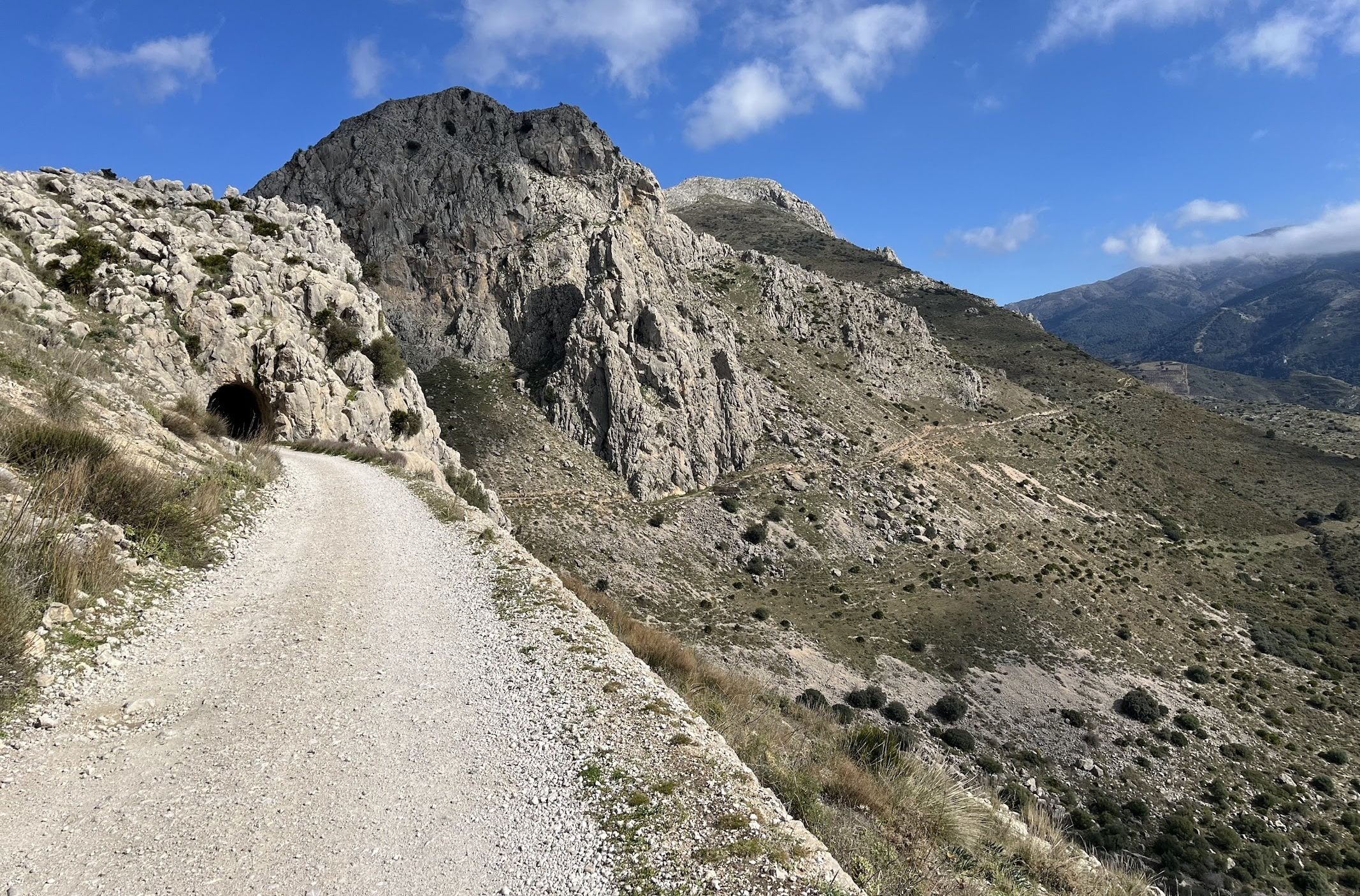
Once out of the town center and the posh outskirts of town, you enter the natural park of Sierras de Tejeda, Almijara y Alhama. For the first stretch, the surface alternates between tarmac and gravel. Judging by the near-vertical drop-offs, I’m guessing these are the results of past landslides. The road snakes ever so slightly deeper into the natural park, and you’ll even come across streams that have running water flowing through them. How about that!
As is quite normal in this neck of the woods, the surface is quite often punishing in any way imaginable. The surface is plastered with large and sharp rocks, potholes big enough to fit a medium-sized dog, and naturally, the gradient goes up towards 18% in some corners. Indeed, off-road cycling is not for beginners here. The climb is worth it though; not only for its natural beauty, but also for what’s about to come later in the ride.
Part 2: the plateau
You’ll get a first glimpse of the joy of downhill riding when you cross the sierras to the plateau around Zafarraya. As mountainous as Málaga, Andalucía, and many parts of Spain are, it’s surprisingly flat around these parts. You’re in ancient bandit country, although nowadays it’s farmers’ country.
An arrow-straight road takes you to Ventas de Zafarraya, the village at the edge of the provinces of Málaga and Granada. Just at the edge of town is the famous Boquete de Zafarraya and the nearby cave. This is where we’re headed.
Part 3: Vía Verde!
An attempt was made in the early 1900s to link Málaga to Granada by train. It was a short-lived success story as cars and highways were constructed at an enormous pace. Not long after, they ceased operating the trains, leaving the track in disarray. There are dozens of similar stories where the train was replaced by other modes of transport, leaving 3,500 km of unused tracks scattered around the country. This is where the Vía Verdes (‘Green Roads’) initiative found its origins, and it’s wonderful. In 2024, a study was conducted to analyze the feasibility of making a Vía Verde out of this particular abandoned train track from Zafarraya to Vélez-Málaga.
If it ever becomes one, it will be a wonderful experience like many of the other Vía Verdes in the country. Today, it’s a little rough around the edges at times, but it’s there and waiting for you to go down, or up, if you’re a bit adventurous. The first few kilometers are relatively flat with wonderful views on both sides. On your left is the valley of Axarquía, on your right you will find the Puerto del Sol, and straight ahead you will find another iconic hill, the Alto de Fraile. In the distance, you can also spot the Sierra de las Nieves on a clear day. Not that you’ll be looking around all that much, given the state of the track.
You’ll be going down like a train on this old train track. It’s so much fun to not have to worry about drivers and just go as fast as you - and nobody else - deem sufficient. It’s an old train track, so you don’t have to worry about unpredictable or sharp corners.
About halfway along the Vía Verde, you need to cross the A-7204 twice to stay on track, or you can take a little shortcut by staying on the A-7204 from Puente Don Manuel to Periana. I missed the last part of the route towards the lake as I thought it was a dead-end, but it would be technically possible to stay off-road all the way. I’ll revisit this route to confirm later. Either way, all roads downhill take you back to the lake of Viñuela. There are lots of fun little passages in the area where you could improvise, as opposed to most other roads in Andalucía. No killer climbs on ill-marked roads where vicious dogs are waiting to cling to your ankles here; it’s just good fun to ride around the lake here.
Fueling up
Alcaucín is the last bit of civilization for the next 20 kilometers until you reach Ventas de Zafarraya. Halfway through the Vía Verde, you can take a quick detour to Periana, or head down to Puente Don Manuel for a well-deserved beverage and a pitufo.